
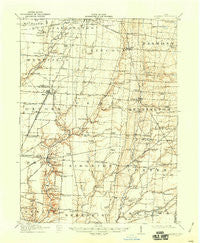
~ Marengo OH topo map, 1:62500 scale, 15 X 15 Minute, Historical, 1915, updated 1946
Marengo, Ohio, USGS topographic map dated 1915.
Includes geographic coordinates (latitude and longitude). This topographic map is suitable for hiking, camping, and exploring, or framing it as a wall map.
Printed on-demand using high resolution imagery, on heavy weight and acid free paper, or alternatively on a variety of synthetic materials.
Topos available on paper, Waterproof, Poly, or Tyvek. Usually shipping rolled, unless combined with other folded maps in one order.
- Product Number: USGS-5321054
- Free digital map download (high-resolution, GeoPDF): Marengo, Ohio (file size: 6 MB)
- Map Size: please refer to the dimensions of the GeoPDF map above
- Weight (paper map): ca. 55 grams
- Map Type: POD USGS Topographic Map
- Map Series: HTMC
- Map Verison: Historical
- Cell ID: 57146
- Scan ID: 225717
- Imprint Year: 1946
- Survey Year: 1912
- Datum: NAD
- Map Projection: Polyconic
- Map published by United States Geological Survey
- Map Language: English
- Scanner Resolution: 600 dpi
- Map Cell Name: Marengo
- Grid size: 15 X 15 Minute
- Date on map: 1915
- Map Scale: 1:62500
- Geographical region: Ohio, United States
Neighboring Maps:
All neighboring USGS topo maps are available for sale online at a variety of scales.
Spatial coverage:
Topo map Marengo, Ohio, covers the geographical area associated the following places:
- Berkshire - Westfield - East Liberty - North Condit - Stark Corners - Morehouse (historical) - Bennington Springs - Pagetown - Fargo - South Woodbury - Vails Corners - Whispering Creek - Sherman Lakes - Sunbury Estates - Kilbourne - Alum Creek - Leonardsburg - West Liberty - Estates At Sherman Lake - Beulah's Mobile Home Park - Kingston Center - Peerless (historical) - Olive Green - Fulton - Condit - Marengo - Ashley - Shawtown
- Map Area ID: AREA40.540.25-83-82.75
- Northwest corner Lat/Long code: USGSNW40.5-83
- Northeast corner Lat/Long code: USGSNE40.5-82.75
- Southwest corner Lat/Long code: USGSSW40.25-83
- Southeast corner Lat/Long code: USGSSE40.25-82.75
- Northern map edge Latitude: 40.5
- Southern map edge Latitude: 40.25
- Western map edge Longitude: -83
- Eastern map edge Longitude: -82.75


