
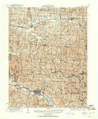
~ Logan OH topo map, 1:62500 scale, 15 X 15 Minute, Historical, 1907, updated 1961
Logan, Ohio, USGS topographic map dated 1907.
Includes geographic coordinates (latitude and longitude). This topographic map is suitable for hiking, camping, and exploring, or framing it as a wall map.
Printed on-demand using high resolution imagery, on heavy weight and acid free paper, or alternatively on a variety of synthetic materials.
Topos available on paper, Waterproof, Poly, or Tyvek. Usually shipping rolled, unless combined with other folded maps in one order.
- Product Number: USGS-5321028
- Free digital map download (high-resolution, GeoPDF): Logan, Ohio (file size: 11 MB)
- Map Size: please refer to the dimensions of the GeoPDF map above
- Weight (paper map): ca. 55 grams
- Map Type: POD USGS Topographic Map
- Map Series: HTMC
- Map Verison: Historical
- Cell ID: 56842
- Scan ID: 225621
- Imprint Year: 1961
- Survey Year: 1907
- Datum: Unstated
- Map Projection: Polyconic
- Map published by United States Geological Survey
- Map Language: English
- Scanner Resolution: 600 dpi
- Map Cell Name: Logan
- Grid size: 15 X 15 Minute
- Date on map: 1907
- Map Scale: 1:62500
- Geographical region: Ohio, United States
Neighboring Maps:
All neighboring USGS topo maps are available for sale online at a variety of scales.
Spatial coverage:
Topo map Logan, Ohio, covers the geographical area associated the following places:
- Bremen - Crossenville - Maxville - Kachelmacher (historical) - Junction City - Webb Summit - Max (historical) - Geneva - Carthon - Maysville - Joe (historical) - Old Gore - Asbury (historical) - Swartz Mill - Winona (historical) - Avlon - Clarksville - South Logan - Oreville - Enterprise - Greendale - North Berne - Logan - Sand Run Junction - Gore - West Logan - Salem - Hide-A-Way Hills - Monday Creek Junction
- Map Area ID: AREA39.7539.5-82.5-82.25
- Northwest corner Lat/Long code: USGSNW39.75-82.5
- Northeast corner Lat/Long code: USGSNE39.75-82.25
- Southwest corner Lat/Long code: USGSSW39.5-82.5
- Southeast corner Lat/Long code: USGSSE39.5-82.25
- Northern map edge Latitude: 39.75
- Southern map edge Latitude: 39.5
- Western map edge Longitude: -82.5
- Eastern map edge Longitude: -82.25


