
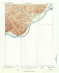
~ Garrison KY topo map, 1:62500 scale, 15 X 15 Minute, Historical, 1915, updated 1952
Garrison, Kentucky, USGS topographic map dated 1915.
Includes geographic coordinates (latitude and longitude). This topographic map is suitable for hiking, camping, and exploring, or framing it as a wall map.
Printed on-demand using high resolution imagery, on heavy weight and acid free paper, or alternatively on a variety of synthetic materials.
Topos available on paper, Waterproof, Poly, or Tyvek. Usually shipping rolled, unless combined with other folded maps in one order.
- Product Number: USGS-5320942
- Free digital map download (high-resolution, GeoPDF): Garrison, Kentucky (file size: 6 MB)
- Map Size: please refer to the dimensions of the GeoPDF map above
- Weight (paper map): ca. 55 grams
- Map Type: POD USGS Topographic Map
- Map Series: HTMC
- Map Verison: Historical
- Cell ID: 54509
- Scan ID: 225171
- Imprint Year: 1952
- Survey Year: 1915
- Datum: NAD27
- Map Projection: Polyconic
- Map published by United States Geological Survey
- Map Language: English
- Scanner Resolution: 600 dpi
- Map Cell Name: Garrison
- Grid size: 15 X 15 Minute
- Date on map: 1915
- Map Scale: 1:62500
- Geographical region: Kentucky, United States
Neighboring Maps:
All neighboring USGS topo maps are available for sale online at a variety of scales.
Spatial coverage:
Topo map Garrison, Kentucky, covers the geographical area associated the following places:
- Letitia - Firebrick - Stockham - Shannoah Town (historical) - Friendship - Rexton - Tannery - Brushart - Alexandria - Quincy - South Portsmouth - Upper Bruce (historical) - McGaw - Kirkville - Pond Run - York - Garrison - Kennvale - Dennis - Saint Paul - Camp Oyo - Truitt - Sugar Grove
- Map Area ID: AREA38.7538.5-83.25-83
- Northwest corner Lat/Long code: USGSNW38.75-83.25
- Northeast corner Lat/Long code: USGSNE38.75-83
- Southwest corner Lat/Long code: USGSSW38.5-83.25
- Southeast corner Lat/Long code: USGSSE38.5-83
- Northern map edge Latitude: 38.75
- Southern map edge Latitude: 38.5
- Western map edge Longitude: -83.25
- Eastern map edge Longitude: -83


