
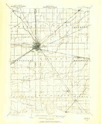
~ Fostoria OH topo map, 1:62500 scale, 15 X 15 Minute, Historical, 1901, updated 1958
Fostoria, Ohio, USGS topographic map dated 1901.
Includes geographic coordinates (latitude and longitude). This topographic map is suitable for hiking, camping, and exploring, or framing it as a wall map.
Printed on-demand using high resolution imagery, on heavy weight and acid free paper, or alternatively on a variety of synthetic materials.
Topos available on paper, Waterproof, Poly, or Tyvek. Usually shipping rolled, unless combined with other folded maps in one order.
- Product Number: USGS-5320910
- Free digital map download (high-resolution, GeoPDF): Fostoria, Ohio (file size: 5 MB)
- Map Size: please refer to the dimensions of the GeoPDF map above
- Weight (paper map): ca. 55 grams
- Map Type: POD USGS Topographic Map
- Map Series: HTMC
- Map Verison: Historical
- Cell ID: 54333
- Scan ID: 225079
- Imprint Year: 1958
- Survey Year: 1901
- Datum: NAD27
- Map Projection: Polyconic
- Map published by United States Geological Survey
- Map Language: English
- Scanner Resolution: 600 dpi
- Map Cell Name: Fostoria
- Grid size: 15 X 15 Minute
- Date on map: 1901
- Map Scale: 1:62500
- Geographical region: Ohio, United States
Neighboring Maps:
All neighboring USGS topo maps are available for sale online at a variety of scales.
Spatial coverage:
Topo map Fostoria, Ohio, covers the geographical area associated the following places:
- Berwick - Iler - Stearns Crest - North Pointe Place Mobile Home Park - Madison Addition - Perry Center - Bascom - Raineys (historical) - Alvada - New Riegel - Nyes Mobile Home Park - Frenchtown - Angus - Westgate Village Park - Adrian - Kansas - Amsden - Fostoria Mobile Estates - Flechtner Heights - Caldwells Addition - Springville - West Independence - Hopewell Estates - Rehoboth - Williams Mobile Home Park - Pelton Mobile Home Park - Longley - West Millgrove - Fostoria - Saint Nicholas (historical)
- Map Area ID: AREA41.2541-83.5-83.25
- Northwest corner Lat/Long code: USGSNW41.25-83.5
- Northeast corner Lat/Long code: USGSNE41.25-83.25
- Southwest corner Lat/Long code: USGSSW41-83.5
- Southeast corner Lat/Long code: USGSSE41-83.25
- Northern map edge Latitude: 41.25
- Southern map edge Latitude: 41
- Western map edge Longitude: -83.5
- Eastern map edge Longitude: -83.25


