
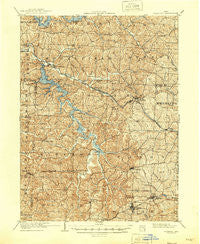
~ Flushing OH topo map, 1:62500 scale, 15 X 15 Minute, Historical, 1905, updated 1946
Flushing, Ohio, USGS topographic map dated 1905.
Includes geographic coordinates (latitude and longitude). This topographic map is suitable for hiking, camping, and exploring, or framing it as a wall map.
Printed on-demand using high resolution imagery, on heavy weight and acid free paper, or alternatively on a variety of synthetic materials.
Topos available on paper, Waterproof, Poly, or Tyvek. Usually shipping rolled, unless combined with other folded maps in one order.
- Product Number: USGS-5320908
- Free digital map download (high-resolution, GeoPDF): Flushing, Ohio (file size: 12 MB)
- Map Size: please refer to the dimensions of the GeoPDF map above
- Weight (paper map): ca. 55 grams
- Map Type: POD USGS Topographic Map
- Map Series: HTMC
- Map Verison: Historical
- Cell ID: 54214
- Scan ID: 225069
- Imprint Year: 1946
- Survey Year: 1903
- Datum: NAD
- Map Projection: Polyconic
- Map published by United States Geological Survey
- Map Language: English
- Scanner Resolution: 600 dpi
- Map Cell Name: Flushing
- Grid size: 15 X 15 Minute
- Date on map: 1905
- Map Scale: 1:62500
- Geographical region: Ohio, United States
Neighboring Maps:
All neighboring USGS topo maps are available for sale online at a variety of scales.
Spatial coverage:
Topo map Flushing, Ohio, covers the geographical area associated the following places:
- East Piedmont - Rock Hill - Kennon (historical) - Hidden Ledges Cottage Area - Holloway - Reynolds Road Cottage Area - Mil-mar Trailer Court - Cabinet - Egypt - Loomis - Badgertown - Piedmont - Belmont - Belmont Ridge - Smyrna - Hilltop Cottage Area - Golda - Lafferty - Morristown - Sewellsville - Fairview - Olivett - Moorefield - Hendrysburg - Goodrich Cottage Area - Oakgrove - Nottingham (historical) - Speidel - Cassville - Loghaven - Bethesda - Flushing
- Map Area ID: AREA40.2540-81.25-81
- Northwest corner Lat/Long code: USGSNW40.25-81.25
- Northeast corner Lat/Long code: USGSNE40.25-81
- Southwest corner Lat/Long code: USGSSW40-81.25
- Southeast corner Lat/Long code: USGSSE40-81
- Northern map edge Latitude: 40.25
- Southern map edge Latitude: 40
- Western map edge Longitude: -81.25
- Eastern map edge Longitude: -81


