
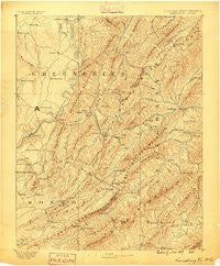
~ Lewisburg WV topo map, 1:125000 scale, 30 X 30 Minute, Historical, 1887
Lewisburg, West Virginia, USGS topographic map dated 1887.
Includes geographic coordinates (latitude and longitude). This topographic map is suitable for hiking, camping, and exploring, or framing it as a wall map.
Printed on-demand using high resolution imagery, on heavy weight and acid free paper, or alternatively on a variety of synthetic materials.
Topos available on paper, Waterproof, Poly, or Tyvek. Usually shipping rolled, unless combined with other folded maps in one order.
- Product Number: USGS-5303948
- Free digital map download (high-resolution, GeoPDF): Lewisburg, West Virginia (file size: 9 MB)
- Map Size: please refer to the dimensions of the GeoPDF map above
- Weight (paper map): ca. 55 grams
- Map Type: POD USGS Topographic Map
- Map Series: HTMC
- Map Verison: Historical
- Cell ID: 65894
- Scan ID: 189026
- Survey Year: 1887
- Datum: Unstated
- Map Projection: Unstated
- Map published by United States Geological Survey
- Map Language: English
- Scanner Resolution: 600 dpi
- Map Cell Name: Lewisburg
- Grid size: 30 X 30 Minute
- Date on map: 1887
- Map Scale: 1:125000
- Geographical region: West Virginia, United States
Neighboring Maps:
All neighboring USGS topo maps are available for sale online at a variety of scales.
Spatial coverage:
Topo map Lewisburg, West Virginia, covers the geographical area associated the following places:
- Gates - Potts Creek - Buckingham Acres - Virginia Mineral Springs - Earlehurst - Alleghany - Dickson - Pedro - Walnut Hills - Teaberry - Mapledale - Marshalltown - Brantville - Bowes - Shryock - Spring Creek - Dogwood Heights - Secondcreek - Clifdale - Crows - Loopemount - Caldwell - Boiling Spring - Paint Bank - Middle Mountain (historical) - Whitcomb (historical) - Fair Oaks Trailer Park - Roxalia - Sweet Springs - Brink (historical) - Sunlight - Henning - Frankford - Hillsdale - Williamsburg - Patton - Tuckahoe - Cedar Knoll Trailer Park - Fort Donnally - New Castle - Unus - Richlands - Rolling Hills - Auto - White Sulphur Springs - Dorr - Hematite - Alvon - Charlton - Fairlea - Hopper - McGlone - Glace - Centennial - Woodman - Blue Bend - Sue - Underwood Estates - Jordan Mines - Laurel Branch - Stonewall - Fuller Trailer Park - Moss Run - Craigs Creek (historical) - Iron Hill Springs - Backbone - Maxwelton - Clendenenville - Gardner - Lewisburg - Anthony - Oakwood Forest - Neola - Gap Mills - Organ Cave - Crowfields - Sweet Chalybeate - Alum Springs (historical) - Morlunda - Westwood Place - Crimson Springs - North Caldwell - Mountain View Estates - Keister - Barbours Creek - Ronceverte - Vago - Monitor - Callaghan - Keenan - Hollywood - Falling Spring - Wild Meadow
- Map Area ID: AREA3837.5-80.5-80
- Northwest corner Lat/Long code: USGSNW38-80.5
- Northeast corner Lat/Long code: USGSNE38-80
- Southwest corner Lat/Long code: USGSSW37.5-80.5
- Southeast corner Lat/Long code: USGSSE37.5-80
- Northern map edge Latitude: 38
- Southern map edge Latitude: 37.5
- Western map edge Longitude: -80.5
- Eastern map edge Longitude: -80


