
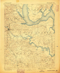
~ Fredericksburg VA topo map, 1:125000 scale, 30 X 30 Minute, Historical, 1889
Fredericksburg, Virginia, USGS topographic map dated 1889.
Includes geographic coordinates (latitude and longitude). This topographic map is suitable for hiking, camping, and exploring, or framing it as a wall map.
Printed on-demand using high resolution imagery, on heavy weight and acid free paper, or alternatively on a variety of synthetic materials.
Topos available on paper, Waterproof, Poly, or Tyvek. Usually shipping rolled, unless combined with other folded maps in one order.
- Product Number: USGS-5303846
- Free digital map download (high-resolution, GeoPDF): Fredericksburg, Virginia (file size: 7 MB)
- Map Size: please refer to the dimensions of the GeoPDF map above
- Weight (paper map): ca. 55 grams
- Map Type: POD USGS Topographic Map
- Map Series: HTMC
- Map Verison: Historical
- Cell ID: 65520
- Scan ID: 188940
- Survey Year: 1888
- Datum: Unstated
- Map Projection: Unstated
- Map published by United States Geological Survey
- Map Language: English
- Scanner Resolution: 600 dpi
- Map Cell Name: Fredericksburg
- Grid size: 30 X 30 Minute
- Date on map: 1889
- Map Scale: 1:125000
- Geographical region: Virginia, United States
Neighboring Maps:
All neighboring USGS topo maps are available for sale online at a variety of scales.
Spatial coverage:
Topo map Fredericksburg, Virginia, covers the geographical area associated the following places:
- Christopher Fork - Youngstead - Gera - Glenwood Forest - Twin Oaks - Garrisonville - Massaponax - Ingleside - Falmouth Heights - Charlestown Commons - Sheltons Run - Featherstone Fork - Aquia Bend - Purkins Corner - Stafford Mews - Holly Ridge - King George - Perry Farms - Abel Lake Forest - Montague Landing - Devon Green - Somerset Landing - Chatham Landing - Spring Lake Farm - Flippos Corner - Welcome - Welchs - Waltlou Mobile Home Park - Villboro - Smith Lake Overlook - Potomac Hills - Bells Run - Michaelbrooke Estates - Courthouse Square at Stafford - Sunshine Acres - Ambar - Liberty - Skywoods - Arbor Glen - Saint Georges - Oakbrooke - Smith Lake Landing - The Oaks Mobile Home Park - Chatham Village - Bald Eagle Hills - Marlboro - Tetotum - Dartmoor - Haymount - Oak Ridge - North Ferry Farms - Prim - Sams Ridge - Heritage Oaks - Grafton (historical) - Hickory Fork - Canterbury Estates - Loy Landing - Hickory Ridge - Summerwood - Stafford Greens - Moss Neck - Lloyds - Brafferton - Sunnyside - Claiborne - Butzner Corner - Ninde - Austin Ridge - Settlers Landing - Cedar Grove - Oakland and Fairview - Upper Zion - Poorhouse Corner - New Hope Estates - Lake Ridge and Bethany Pointe - Little Falls Village - Raintree - Meadowood Village - O Bannon Land - Pullers Corner - Locklears Knoll - Freedom Estates - Heritage Commons - Brentwood Estates - Graninger - Estates of Widewater Pond - Hampton Oaks - Uly Brooks - Paige - Moreland - River Heights - McCarthys Corner - Aquia Inlet Estates - Bristol (historical) - Joseph Sullivan Estates - Stowe of Amyclae - Boscobel - Stafford - Etta
- Map Area ID: AREA38.538-77.5-77
- Northwest corner Lat/Long code: USGSNW38.5-77.5
- Northeast corner Lat/Long code: USGSNE38.5-77
- Southwest corner Lat/Long code: USGSSW38-77.5
- Southeast corner Lat/Long code: USGSSE38-77
- Northern map edge Latitude: 38.5
- Southern map edge Latitude: 38
- Western map edge Longitude: -77.5
- Eastern map edge Longitude: -77


