
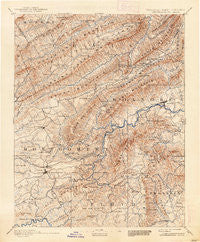
~ Christiansburg VA topo map, 1:125000 scale, 30 X 30 Minute, Historical, 1890, updated 1938
Christiansburg, Virginia, USGS topographic map dated 1890.
Includes geographic coordinates (latitude and longitude). This topographic map is suitable for hiking, camping, and exploring, or framing it as a wall map.
Printed on-demand using high resolution imagery, on heavy weight and acid free paper, or alternatively on a variety of synthetic materials.
Topos available on paper, Waterproof, Poly, or Tyvek. Usually shipping rolled, unless combined with other folded maps in one order.
- Product Number: USGS-5303804
- Free digital map download (high-resolution, GeoPDF): Christiansburg, Virginia (file size: 9 MB)
- Map Size: please refer to the dimensions of the GeoPDF map above
- Weight (paper map): ca. 55 grams
- Map Type: POD USGS Topographic Map
- Map Series: HTMC
- Map Verison: Historical
- Cell ID: 65201
- Scan ID: 188902
- Imprint Year: 1938
- Survey Year: 1887
- Datum: Unstated
- Map Projection: Polyconic
- Map published by United States Geological Survey
- Map Language: English
- Scanner Resolution: 600 dpi
- Map Cell Name: Christiansburg
- Grid size: 30 X 30 Minute
- Date on map: 1890
- Map Scale: 1:125000
- Geographical region: Virginia, United States
Neighboring Maps:
All neighboring USGS topo maps are available for sale online at a variety of scales.
Spatial coverage:
Topo map Christiansburg, Virginia, covers the geographical area associated the following places:
- Windsor West - City View Heights - Blue Ridge Park - Laurel Woods - Victory Heights - Town and Country Estates - Meadow Run - Cedar Orchard - Andrew Lewis - Alleghany Heights - Callaway - Elliston - Nichols Estates - Hilltop Plaza - Moneiro - Belle Meade - Hillcrest Heights - Glen Forest - Hidden Valley - Riverside - Medmont Lake - Robin Hood Park - Middleton Gardens - Hidden Valley Court - Castle Rock West - Bennetts Mill - Franklin Park - Beverly Hills - Bear Rock - Rolling Hills - Carolyn Heights - Pheasant Run - Cumberland Forest - Snidow Heights - Highview Terrace - Dawnwood Forest - Willow Green - Brumfield Acres - Orchard Heights - Country Hills - Melody Acres - Homewood - Stonegate - Bonvue Heights - Kings Forest - Hidden Valley Homes - Lake Spring - Hemlock Hills - Langhorne Place - Poages Mill Estates - Cherry Hill - Boxwood Hills - Sugar Loaf Farms - Taryn Hills - Preston Forest - Orchard View - Spangler - Algoma - Old Farm Village - Mount Tabor - Cliffview - Hidden Valley Estates - Green Hill Terrace - Montgomery White Sulphur Springs (historical) - Mount Vernon Heights - Pilgrims Pointe - Lester Place - Country Club Estates - Newport - Briar Ridge - Lee-Mitchell - Glenvar East - Stonegate - Woodlyn - East Park Addition - Salem Village Trailer Park - Southwoods - Cameron Court - Homeplace - Karr Heights - Rainbow Ridge - Medley - Montgomery - Windsor Court - Glade Road Heights - Mount Regis Heights - Hill Subdivision - Newcomb Heights - Kenwick Place - Ramble Ridge - Mockingbird Hill - Ellett - Shadeland Addition - Cherokee Hills - Shawsville - Keslers Mill - Tinker (historical) - Airpoint - Mountain Brook Estates - Lafayette
- Map Area ID: AREA37.537-80.5-80
- Northwest corner Lat/Long code: USGSNW37.5-80.5
- Northeast corner Lat/Long code: USGSNE37.5-80
- Southwest corner Lat/Long code: USGSSW37-80.5
- Southeast corner Lat/Long code: USGSSE37-80
- Northern map edge Latitude: 37.5
- Southern map edge Latitude: 37
- Western map edge Longitude: -80.5
- Eastern map edge Longitude: -80


