
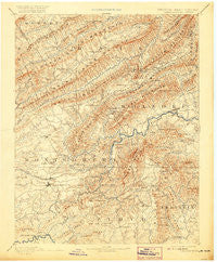
~ Christiansburg VA topo map, 1:125000 scale, 30 X 30 Minute, Historical, 1890, updated 1920
Christiansburg, Virginia, USGS topographic map dated 1890.
Includes geographic coordinates (latitude and longitude). This topographic map is suitable for hiking, camping, and exploring, or framing it as a wall map.
Printed on-demand using high resolution imagery, on heavy weight and acid free paper, or alternatively on a variety of synthetic materials.
Topos available on paper, Waterproof, Poly, or Tyvek. Usually shipping rolled, unless combined with other folded maps in one order.
- Product Number: USGS-5303800
- Free digital map download (high-resolution, GeoPDF): Christiansburg, Virginia (file size: 9 MB)
- Map Size: please refer to the dimensions of the GeoPDF map above
- Weight (paper map): ca. 55 grams
- Map Type: POD USGS Topographic Map
- Map Series: HTMC
- Map Verison: Historical
- Cell ID: 65201
- Scan ID: 188899
- Imprint Year: 1920
- Survey Year: 1887
- Datum: Unstated
- Map Projection: Unstated
- Map published by United States Geological Survey
- Map Language: English
- Scanner Resolution: 600 dpi
- Map Cell Name: Christiansburg
- Grid size: 30 X 30 Minute
- Date on map: 1890
- Map Scale: 1:125000
- Geographical region: Virginia, United States
Neighboring Maps:
All neighboring USGS topo maps are available for sale online at a variety of scales.
Spatial coverage:
Topo map Christiansburg, Virginia, covers the geographical area associated the following places:
- Marvin Garden Subdivision - Dropmore - Monticello Estates - Poages Mill Estates - Homewood - Scenic Hills - Vicker - White Pine - Franklin Park - Oak Ridge - Webbs Mill - Brush Harbor - Clover Valley - Keister Addition - Gunn - Windsor West - Lee-Hi Court - Farris Heights - Hemlock - Echo Hills - Suburban Hills - Bangs (historical) - Myers Acres - Ingleside - Westover Hills - Brookwood - Morwanda Park - Lake Spring - Hidden Valley Court - Naff - Eton Hill - Glen Cove - Wyndale - Kings Forest - Alleghany Addition - Evans Hill - Riverside - Crestwood Gardens - Walnut Grove - Hidden Acres - Dundas Heights - Patrick Henry Place - Ponderosa Park - Lake Spring Land - Pine Bluff - Rainbow Ridge - Riverside Estates - Castle Rock West - Cherry Hill Park - Panorama Heights - Lee-Mitchell - Woodside Park - Roanoke Red Sulphur Springs - Forest Hills (historical) - Arlington Forest - Waiteville - Glenvar East - University Place - Raintree Village - Preston Forest - Mountain View Estates - Southside Hills - Spradlin Addition - Crestmoor Court - Valley Mill - West Chester - Diamond Pointe - Kimball Acres - Andrew Lewis - Shelor Acres - Highland Park - Bent Mountain - Washington Heights - Rogers - Hillview Park - Maggie - Braeburn - Shawsville - Elliston - Skyview - Woodmont Manor - Sugar Loaf Farms - Cliffview - Willow Green - Orchard Heights - Longview Estates - Fairview - Spring Garden - Kenwick Place - Braxton Heights - Hemlock Hills - Arlington Hills - The Vistas - Westward Lake Estates - Pilgrims Pointe - Woodlawn - Edgelawn - Sunset Village - Ironto - Cherry Hill
- Map Area ID: AREA37.537-80.5-80
- Northwest corner Lat/Long code: USGSNW37.5-80.5
- Northeast corner Lat/Long code: USGSNE37.5-80
- Southwest corner Lat/Long code: USGSSW37-80.5
- Southeast corner Lat/Long code: USGSSE37-80
- Northern map edge Latitude: 37.5
- Southern map edge Latitude: 37
- Western map edge Longitude: -80.5
- Eastern map edge Longitude: -80


