
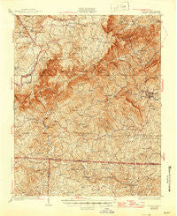
~ Stuart VA topo map, 1:62500 scale, 15 X 15 Minute, Historical, 1931, updated 1945
Stuart, Virginia, USGS topographic map dated 1931.
Includes geographic coordinates (latitude and longitude). This topographic map is suitable for hiking, camping, and exploring, or framing it as a wall map.
Printed on-demand using high resolution imagery, on heavy weight and acid free paper, or alternatively on a variety of synthetic materials.
Topos available on paper, Waterproof, Poly, or Tyvek. Usually shipping rolled, unless combined with other folded maps in one order.
- Product Number: USGS-5303458
- Free digital map download (high-resolution, GeoPDF): Stuart, Virginia (file size: 12 MB)
- Map Size: please refer to the dimensions of the GeoPDF map above
- Weight (paper map): ca. 55 grams
- Map Type: POD USGS Topographic Map
- Map Series: HTMC
- Map Verison: Historical
- Cell ID: 63044
- Scan ID: 188618
- Imprint Year: 1945
- Survey Year: 1928
- Datum: NAD
- Map Projection: Polyconic
- Map published by United States Geological Survey
- Map Language: English
- Scanner Resolution: 600 dpi
- Map Cell Name: Stuart
- Grid size: 15 X 15 Minute
- Date on map: 1931
- Map Scale: 1:62500
- Geographical region: Virginia, United States
Neighboring Maps:
All neighboring USGS topo maps are available for sale online at a variety of scales.
Spatial coverage:
Topo map Stuart, Virginia, covers the geographical area associated the following places:
- Albion - Stuart - Kibler Valley - Harts Store - Woodville - Vesta - Asbury - Dry Pond - Five Forks - Belair Springs - Carters Mill - Cruzes Store - Francisco - Meadowfield - Dobyns - Collinstown - Aarons Corner - Pike City - Mount Herman - Peters Creek - Claudville - Brim (historical)
- Map Area ID: AREA36.7536.5-80.5-80.25
- Northwest corner Lat/Long code: USGSNW36.75-80.5
- Northeast corner Lat/Long code: USGSNE36.75-80.25
- Southwest corner Lat/Long code: USGSSW36.5-80.5
- Southeast corner Lat/Long code: USGSSE36.5-80.25
- Northern map edge Latitude: 36.75
- Southern map edge Latitude: 36.5
- Western map edge Longitude: -80.5
- Eastern map edge Longitude: -80.25


