
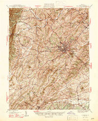
~ Staunton VA topo map, 1:62500 scale, 15 X 15 Minute, Historical, 1947
Staunton, Virginia, USGS topographic map dated 1947.
Includes geographic coordinates (latitude and longitude). This topographic map is suitable for hiking, camping, and exploring, or framing it as a wall map.
Printed on-demand using high resolution imagery, on heavy weight and acid free paper, or alternatively on a variety of synthetic materials.
Topos available on paper, Waterproof, Poly, or Tyvek. Usually shipping rolled, unless combined with other folded maps in one order.
- Product Number: USGS-5303422
- Free digital map download (high-resolution, GeoPDF): Staunton, Virginia (file size: 11 MB)
- Map Size: please refer to the dimensions of the GeoPDF map above
- Weight (paper map): ca. 55 grams
- Map Type: POD USGS Topographic Map
- Map Series: HTMC
- Map Verison: Historical
- Cell ID: 62940
- Scan ID: 188594
- Woodland Tint: Yes
- Datum: NAD27
- Map Projection: Polyconic
- Map published by United States Geological Survey
- Map Language: English
- Scanner Resolution: 600 dpi
- Map Cell Name: Staunton
- Grid size: 15 X 15 Minute
- Date on map: 1947
- Map Scale: 1:62500
- Geographical region: Virginia, United States
Neighboring Maps:
All neighboring USGS topo maps are available for sale online at a variety of scales.
Spatial coverage:
Topo map Staunton, Virginia, covers the geographical area associated the following places:
- West View - Buffalo Gap - Greenville - Peyton - Swoope - Quicks Mill - Rivermont - Hebron - Lone Fountain - Woodlee - Selma - Jolivue - Snyder - Shenandoah Valley Estates - Wilda - Franks Mill - West End - Dogwood Hill - Staunton - Trimbles Mill - Plunkettsville - Churchville - Staunton Park - Brand - Stuarts Draft - Brookwood - Verona - College Park - Cedar Green - Barterbrook - Millbrook - Skymont - Middlebrook - Arbor Hill - Avis - White Hill - Folly Mills - Christian - Mint Spring
- Map Area ID: AREA38.2538-79.25-79
- Northwest corner Lat/Long code: USGSNW38.25-79.25
- Northeast corner Lat/Long code: USGSNE38.25-79
- Southwest corner Lat/Long code: USGSSW38-79.25
- Southeast corner Lat/Long code: USGSSE38-79
- Northern map edge Latitude: 38.25
- Southern map edge Latitude: 38
- Western map edge Longitude: -79.25
- Eastern map edge Longitude: -79


