
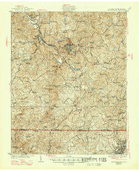
~ Martinsville VA topo map, 1:62500 scale, 15 X 15 Minute, Historical, 1927, updated 1947
Martinsville, Virginia, USGS topographic map dated 1927.
Includes geographic coordinates (latitude and longitude). This topographic map is suitable for hiking, camping, and exploring, or framing it as a wall map.
Printed on-demand using high resolution imagery, on heavy weight and acid free paper, or alternatively on a variety of synthetic materials.
Topos available on paper, Waterproof, Poly, or Tyvek. Usually shipping rolled, unless combined with other folded maps in one order.
- Product Number: USGS-5303072
- Free digital map download (high-resolution, GeoPDF): Martinsville, Virginia (file size: 11 MB)
- Map Size: please refer to the dimensions of the GeoPDF map above
- Weight (paper map): ca. 55 grams
- Map Type: POD USGS Topographic Map
- Map Series: HTMC
- Map Verison: Historical
- Cell ID: 57242
- Scan ID: 188308
- Imprint Year: 1947
- Survey Year: 1924
- Datum: NAD
- Map Projection: Polyconic
- Map published by United States Geological Survey
- Map Language: English
- Scanner Resolution: 600 dpi
- Map Cell Name: Martinsville
- Grid size: 15 X 15 Minute
- Date on map: 1927
- Map Scale: 1:62500
- Geographical region: Virginia, United States
Neighboring Maps:
All neighboring USGS topo maps are available for sale online at a variety of scales.
Spatial coverage:
Topo map Martinsville, Virginia, covers the geographical area associated the following places:
- Rock Run - Chatmoss - Grassy Creek - Carlisle - Fairview - Lithia Springs - Horse Pasture - Rangeley - Matrimony - Shannon Hills - Laurel Park - Heusley - Hamilton Hills - Lakewood Forest - Spray (historical) - Sheffield Terrace - Bassett Forks - Stanleytown - Fieldale - Brandywine Estates - Martinsville - Old Liberty - Collinsville - Hilltop - Quesenbury - Payne - Leaksville (historical) - Glen Court - Chestnut Knob - Ridgeway - Koehler - Irisburg - Jones Creek - Price - Marrowbone Heights - Villa Heights - Preston - Fontaine
- Map Area ID: AREA36.7536.5-80-79.75
- Northwest corner Lat/Long code: USGSNW36.75-80
- Northeast corner Lat/Long code: USGSNE36.75-79.75
- Southwest corner Lat/Long code: USGSSW36.5-80
- Southeast corner Lat/Long code: USGSSE36.5-79.75
- Northern map edge Latitude: 36.75
- Southern map edge Latitude: 36.5
- Western map edge Longitude: -80
- Eastern map edge Longitude: -79.75


