
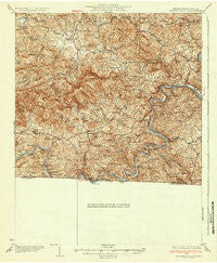
~ Independence VA topo map, 1:62500 scale, 15 X 15 Minute, Historical, 1933
Independence, Virginia, USGS topographic map dated 1933.
Includes geographic coordinates (latitude and longitude). This topographic map is suitable for hiking, camping, and exploring, or framing it as a wall map.
Printed on-demand using high resolution imagery, on heavy weight and acid free paper, or alternatively on a variety of synthetic materials.
Topos available on paper, Waterproof, Poly, or Tyvek. Usually shipping rolled, unless combined with other folded maps in one order.
- Product Number: USGS-5302958
- Free digital map download (high-resolution, GeoPDF): Independence, Virginia (file size: 10 MB)
- Map Size: please refer to the dimensions of the GeoPDF map above
- Weight (paper map): ca. 55 grams
- Map Type: POD USGS Topographic Map
- Map Series: HTMC
- Map Verison: Historical
- Cell ID: 55730
- Scan ID: 188207
- Survey Year: 1930
- Datum: NAD
- Map Projection: Polyconic
- Map published by United States Geological Survey
- Map Language: English
- Scanner Resolution: 600 dpi
- Map Cell Name: Independence
- Grid size: 15 X 15 Minute
- Date on map: 1933
- Map Scale: 1:62500
- Geographical region: Virginia, United States
Neighboring Maps:
All neighboring USGS topo maps are available for sale online at a variety of scales.
Spatial coverage:
Topo map Independence, Virginia, covers the geographical area associated the following places:
- Elk Creek - Carsonville - Bennington Mill - Independence - Lower Elk Creek - Stratford - Spring Valley - Amelia - Sparta - Clito Mill - New Haven - Edwards Crossroads - Riverside - Vox - Blevins Crossroads - Fallville - Hooker - Peach Bottom - Providence - Baywood - Bridle Creek - Comers Rock - Chestnut Grove - Twin Oaks - Turkey Fork
- Map Area ID: AREA36.7536.5-81.25-81
- Northwest corner Lat/Long code: USGSNW36.75-81.25
- Northeast corner Lat/Long code: USGSNE36.75-81
- Southwest corner Lat/Long code: USGSSW36.5-81.25
- Southeast corner Lat/Long code: USGSSE36.5-81
- Northern map edge Latitude: 36.75
- Southern map edge Latitude: 36.5
- Western map edge Longitude: -81.25
- Eastern map edge Longitude: -81


