
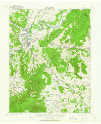
~ Front Royal VA topo map, 1:62500 scale, 15 X 15 Minute, Historical, 1939, updated 1965
Front Royal, Virginia, USGS topographic map dated 1939.
Includes geographic coordinates (latitude and longitude). This topographic map is suitable for hiking, camping, and exploring, or framing it as a wall map.
Printed on-demand using high resolution imagery, on heavy weight and acid free paper, or alternatively on a variety of synthetic materials.
Topos available on paper, Waterproof, Poly, or Tyvek. Usually shipping rolled, unless combined with other folded maps in one order.
- Product Number: USGS-5302888
- Free digital map download (high-resolution, GeoPDF): Front Royal, Virginia (file size: 8 MB)
- Map Size: please refer to the dimensions of the GeoPDF map above
- Weight (paper map): ca. 55 grams
- Map Type: POD USGS Topographic Map
- Map Series: HTMC
- Map Verison: Historical
- Cell ID: 54419
- Scan ID: 188124
- Imprint Year: 1965
- Woodland Tint: Yes
- Survey Year: 1939
- Datum: NAD27
- Map Projection: Polyconic
- Map published by United States Geological Survey
- Map Language: English
- Scanner Resolution: 600 dpi
- Map Cell Name: Front Royal
- Grid size: 15 X 15 Minute
- Date on map: 1939
- Map Scale: 1:62500
- Geographical region: Virginia, United States
Neighboring Maps:
All neighboring USGS topo maps are available for sale online at a variety of scales.
Spatial coverage:
Topo map Front Royal, Virginia, covers the geographical area associated the following places:
- Riverton Junction - Shenandoah Farms - Royal Village - Sea Lock - Riverside - Colonial Park - Front Royal - Heritage - Benny Megeath - Arco - Huntly - Country Club View - Downing (historical) - Petersburg - Viscose City - Williamsburg Estates - Warren Park - Grandview Estates - Vaught Estates - Blue Ridge Mountains Estates - Boyds Mill - Sans Facon - Hensel Stone Woods - Lake Front Royal - Cedarville - The Lions Den - Success - Deer Haven - Mineral Springs - Shenandoah River Estates - River View - McCoy - Elwood Acres - Loch Linden - Apple Mountain Lake West - Skyline View Mobile Home Park - Reager - Markham - Keysville - Cresthill - Mountain View - Highland Park - Howellsville - Point O'Woods - Glen Echo - Skyland Estates - Belmont - Blue Mountain - Linden Heights - Front Royal Junction - Harrell Corner - Hill and Dale - Wakefield Manor - Merrymount - Monterey Orchards - Rockland - Green Hill Forest - Ben Mar - Joy Spring - Happy Creek - Riverton - Linden - Belle Meade - Shenandoah Shores - Chester Gap - Flint Hill - Shenandoah Homesteads Project - Woodland Park - Dungadin Heights - Browntown - Applewood - Apple Mountain Lake - Kemp Park
- Map Area ID: AREA3938.75-78.25-78
- Northwest corner Lat/Long code: USGSNW39-78.25
- Northeast corner Lat/Long code: USGSNE39-78
- Southwest corner Lat/Long code: USGSSW38.75-78.25
- Southeast corner Lat/Long code: USGSSE38.75-78
- Northern map edge Latitude: 39
- Southern map edge Latitude: 38.75
- Western map edge Longitude: -78.25
- Eastern map edge Longitude: -78


