
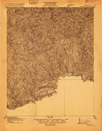
~ Richlands VA topo map, 1:48000 scale, 15 X 15 Minute, Historical, 1915
Richlands, Virginia, USGS topographic map dated 1915.
Includes geographic coordinates (latitude and longitude). This topographic map is suitable for hiking, camping, and exploring, or framing it as a wall map.
Printed on-demand using high resolution imagery, on heavy weight and acid free paper, or alternatively on a variety of synthetic materials.
Topos available on paper, Waterproof, Poly, or Tyvek. Usually shipping rolled, unless combined with other folded maps in one order.
- Product Number: USGS-5302520
- Free digital map download (high-resolution, GeoPDF): Richlands, Virginia (file size: 16 MB)
- Map Size: please refer to the dimensions of the GeoPDF map above
- Weight (paper map): ca. 55 grams
- Map Type: POD USGS Topographic Map
- Map Series: HTMC
- Map Verison: Historical
- Cell ID: 61599
- Scan ID: 187739
- Survey Year: 1915
- Datum: Unstated
- Map Projection: Unstated
- Advance: Yes
- Map published by United States Geological Survey
- Keywords: Nonstandard Press Run
- Map Language: English
- Scanner Resolution: 600 dpi
- Map Cell Name: Richlands
- Grid size: 15 X 15 Minute
- Date on map: 1915
- Map Scale: 1:48000
- Geographical region: Virginia, United States
Neighboring Maps:
All neighboring USGS topo maps are available for sale online at a variety of scales.
Spatial coverage:
Topo map Richlands, Virginia, covers the geographical area associated the following places:
- Shack Mills - Fork Ridge - Keen Mountain - Seaboard - Sulphur Spring (historical) - Lynn Spring - Indian - West Raven - Glen Burke - Paintlick - Laurel - Birmingham - Claypool Hill - Daw - Putnam - Vandyke - Coaldan - Whitewood - Jewell Ridge - Richlands - Dye - Swords Creek - Hickory Junction - Clell - Premier - Steeleburg - Wardell - Dalton Addition - Flatrock - Marvin - Jewell Valley - Honaker - Raven - Doran - Roth - Cedar Bluff - Red Ash - Horn - Lake Park - Afredton - Clifton - Gardner - Shortt Gap - Grimsleyville - Page - Garden - Tarkiln - Russell
- Map Area ID: AREA37.2537-82-81.75
- Northwest corner Lat/Long code: USGSNW37.25-82
- Northeast corner Lat/Long code: USGSNE37.25-81.75
- Southwest corner Lat/Long code: USGSSW37-82
- Southeast corner Lat/Long code: USGSSE37-81.75
- Northern map edge Latitude: 37.25
- Southern map edge Latitude: 37
- Western map edge Longitude: -82
- Eastern map edge Longitude: -81.75


