
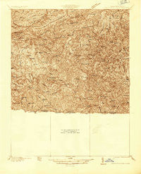
~ Mouth of Wilson VA topo map, 1:48000 scale, 15 X 15 Minute, Historical, 1935
Mouth of Wilson, Virginia, USGS topographic map dated 1935.
Includes geographic coordinates (latitude and longitude). This topographic map is suitable for hiking, camping, and exploring, or framing it as a wall map.
Printed on-demand using high resolution imagery, on heavy weight and acid free paper, or alternatively on a variety of synthetic materials.
Topos available on paper, Waterproof, Poly, or Tyvek. Usually shipping rolled, unless combined with other folded maps in one order.
- Product Number: USGS-5302514
- Free digital map download (high-resolution, GeoPDF): Mouth of Wilson, Virginia (file size: 14 MB)
- Map Size: please refer to the dimensions of the GeoPDF map above
- Weight (paper map): ca. 55 grams
- Map Type: POD USGS Topographic Map
- Map Series: HTMC
- Map Verison: Historical
- Cell ID: 58165
- Scan ID: 187721
- Survey Year: 1935
- Datum: NAD27
- Map Projection: Unstated
- Advance: Yes
- Map published by United States Geological Survey
- Keywords: Nonstandard Press Run
- Map Language: English
- Scanner Resolution: 600 dpi
- Map Cell Name: Mouth of Wilson
- Grid size: 15 X 15 Minute
- Date on map: 1935
- Map Scale: 1:48000
- Geographical region: Virginia, United States
Neighboring Maps:
All neighboring USGS topo maps are available for sale online at a variety of scales.
Spatial coverage:
Topo map Mouth of Wilson, Virginia, covers the geographical area associated the following places:
- Topia - Trout Dale - Grassy Creek - Sturgills - Crumpler - Helton - Volney - Fox - Sessex - Rugby - Flat Ridge - Mouth of Wilson - Grant - Barton Crossroad - Kings Creek - Mount Zion - Fairwood - Mill Creek - Weavers Ford - Piney Creek - Chestnut Hill - Oak Hill
- Map Area ID: AREA36.7536.5-81.5-81.25
- Northwest corner Lat/Long code: USGSNW36.75-81.5
- Northeast corner Lat/Long code: USGSNE36.75-81.25
- Southwest corner Lat/Long code: USGSSW36.5-81.5
- Southeast corner Lat/Long code: USGSSE36.5-81.25
- Northern map edge Latitude: 36.75
- Southern map edge Latitude: 36.5
- Western map edge Longitude: -81.5
- Eastern map edge Longitude: -81.25


