
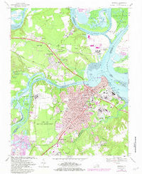
~ Hopewell VA topo map, 1:24000 scale, 7.5 X 7.5 Minute, Historical, 1969, updated 1981
Hopewell, Virginia, USGS topographic map dated 1969.
Includes geographic coordinates (latitude and longitude). This topographic map is suitable for hiking, camping, and exploring, or framing it as a wall map.
Printed on-demand using high resolution imagery, on heavy weight and acid free paper, or alternatively on a variety of synthetic materials.
Topos available on paper, Waterproof, Poly, or Tyvek. Usually shipping rolled, unless combined with other folded maps in one order.
- Product Number: USGS-5298812
- Free digital map download (high-resolution, GeoPDF): Hopewell, Virginia (file size: 12 MB)
- Map Size: please refer to the dimensions of the GeoPDF map above
- Weight (paper map): ca. 55 grams
- Map Type: POD USGS Topographic Map
- Map Series: HTMC
- Map Verison: Historical
- Cell ID: 20982
- Scan ID: 185413
- Imprint Year: 1981
- Woodland Tint: Yes
- Photo Revision Year: 1981
- Aerial Photo Year: 1979
- Edit Year: 1981
- Field Check Year: 1969
- Datum: NAD27
- Map Projection: Polyconic
- Map published by United States Geological Survey
- Map Language: English
- Scanner Resolution: 600 dpi
- Map Cell Name: Hopewell
- Grid size: 7.5 X 7.5 Minute
- Date on map: 1969
- Map Scale: 1:24000
- Geographical region: Virginia, United States
Neighboring Maps:
All neighboring USGS topo maps are available for sale online at a variety of scales.
Spatial coverage:
Topo map Hopewell, Virginia, covers the geographical area associated the following places:
- Upper Shirley - Red Hill Mobile Home Park - Walthall Mill - Sherman Corner - Five Forks - Mount Blanco - Kenwood - City Point (historical) - Screamersville - Riverdale Mobile Home Park - Birchett Estate - Rivermont - Newstead Farm - Arlington - Irwin Manor - Cedar Level - Hopewell - Meadowville - Woodvale - Presque Isle - Stratford Woods - Perkinson Heights - Osbornes (historical) - Enon - Riverdale - Appomattoc (historical) - Jefferson Park - Sherman Park - Manchester Mill - Ocre (historical) - Cameron Hills - Nimitz Trailer Park - Shirley - Highland Park
- Map Area ID: AREA37.37537.25-77.375-77.25
- Northwest corner Lat/Long code: USGSNW37.375-77.375
- Northeast corner Lat/Long code: USGSNE37.375-77.25
- Southwest corner Lat/Long code: USGSSW37.25-77.375
- Southeast corner Lat/Long code: USGSSE37.25-77.25
- Northern map edge Latitude: 37.375
- Southern map edge Latitude: 37.25
- Western map edge Longitude: -77.375
- Eastern map edge Longitude: -77.25


