
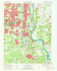
~ Drewrys Bluff VA topo map, 1:24000 scale, 7.5 X 7.5 Minute, Historical, 1969, updated 1971
Drewrys Bluff, Virginia, USGS topographic map dated 1969.
Includes geographic coordinates (latitude and longitude). This topographic map is suitable for hiking, camping, and exploring, or framing it as a wall map.
Printed on-demand using high resolution imagery, on heavy weight and acid free paper, or alternatively on a variety of synthetic materials.
Topos available on paper, Waterproof, Poly, or Tyvek. Usually shipping rolled, unless combined with other folded maps in one order.
- Product Number: USGS-5297746
- Free digital map download (high-resolution, GeoPDF): Drewrys Bluff, Virginia (file size: 12 MB)
- Map Size: please refer to the dimensions of the GeoPDF map above
- Weight (paper map): ca. 55 grams
- Map Type: POD USGS Topographic Map
- Map Series: HTMC
- Map Verison: Historical
- Cell ID: 12785
- Scan ID: 184782
- Imprint Year: 1971
- Woodland Tint: Yes
- Aerial Photo Year: 1968
- Field Check Year: 1969
- Survey Year: 1938
- Datum: NAD27
- Map Projection: Polyconic
- Map published by United States Geological Survey
- Map Language: English
- Scanner Resolution: 600 dpi
- Map Cell Name: Drewrys Bluff
- Grid size: 7.5 X 7.5 Minute
- Date on map: 1969
- Map Scale: 1:24000
- Geographical region: Virginia, United States
Neighboring Maps:
All neighboring USGS topo maps are available for sale online at a variety of scales.
Spatial coverage:
Topo map Drewrys Bluff, Virginia, covers the geographical area associated the following places:
- Kendale - Lost Forest - Centralia Gardens - Salem Woods - Central Park - Chesswood - Brittonwood - Cedar Farms - Chimney Corner - Holiday Park Trailer Park - Kingsland Acres - Indian Springs - Broad Rock - The Mews - Beulah - Pebble Spring - Ampthill Heights - Broad Rock Manor - Centralia - Bellwood - Chesterfield Court - Cherry Gardens - Piney Knolls - Quail Oaks - Bensley - Scottdale - Meadowbrook - Courthouse Green - Bellwood Estates - Dorchester - Hunting Creek Hills - Jean Court - Bellwood Manor - Bellmeade - Bellwood Terrace - Kimberly Acres - Patromdale - Warwick Mobile Home Park - Walmsley Village - Clopton - Capitol View - Felipos Mobile Court - Ampt Hill - Beulah Village - Warwick - Bensley Village - Crescent Park - Brookbury - Howlett Park - Afton - Drewrys Bluff - Brentwood - South Garden - Oakland - Richmond Heights - Worsham Trailer Park
- Map Area ID: AREA37.537.375-77.5-77.375
- Northwest corner Lat/Long code: USGSNW37.5-77.5
- Northeast corner Lat/Long code: USGSNE37.5-77.375
- Southwest corner Lat/Long code: USGSSW37.375-77.5
- Southeast corner Lat/Long code: USGSSE37.375-77.375
- Northern map edge Latitude: 37.5
- Southern map edge Latitude: 37.375
- Western map edge Longitude: -77.5
- Eastern map edge Longitude: -77.375


