
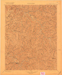
~ Salyersville KY topo map, 1:125000 scale, 30 X 30 Minute, Historical, 1899, updated 1918
Salyersville, Kentucky, USGS topographic map dated 1899.
Includes geographic coordinates (latitude and longitude). This topographic map is suitable for hiking, camping, and exploring, or framing it as a wall map.
Printed on-demand using high resolution imagery, on heavy weight and acid free paper, or alternatively on a variety of synthetic materials.
Topos available on paper, Waterproof, Poly, or Tyvek. Usually shipping rolled, unless combined with other folded maps in one order.
- Product Number: USGS-5294982
- Free digital map download (high-resolution, GeoPDF): Salyersville, Kentucky (file size: 7 MB)
- Map Size: please refer to the dimensions of the GeoPDF map above
- Weight (paper map): ca. 55 grams
- Map Type: POD USGS Topographic Map
- Map Series: HTMC
- Map Verison: Historical
- Cell ID: 66579
- Scan ID: 804306
- Imprint Year: 1918
- Survey Year: 1897
- Datum: Unstated
- Map Projection: Unstated
- Map published by United States Geological Survey
- Map Language: English
- Scanner Resolution: 508 dpi
- Map Cell Name: Saylersville
- Grid size: 30 X 30 Minute
- Date on map: 1899
- Map Scale: 1:125000
- Geographical region: Kentucky, United States
Neighboring Maps:
All neighboring USGS topo maps are available for sale online at a variety of scales.
Spatial coverage:
Topo map Salyersville, Kentucky, covers the geographical area associated the following places:
- Dan - Bonny - Payton - Salyersville - Harper - Nickell - Lexie - Maggard - Cutuno - Minefork - Elkfork - Moct - Bethanna - Press - Bays - Upper Gillmore - Mountain Valley - Neal Valley (historical) - Fritz - Logville - Murphyfork - Wilhurst - Sublett - Lambric - Road Fork (historical) - Upper Sandlick (historical) - Crockett - Upper White Oak Creek (historical) - Lakeville - Hager - Ova - Stevenson - Cindas Creek - Seitz - Tarkiln (historical) - Woodsbend - Gifford - Flat Rock (historical) - West Liberty - Lower Gillmore - Lawson - Mason - Cottle - Right Fork (historical) - Simpson - Leatha - Royalton - Trent - Flat Fork - Yocum - Middle Fork (historical) - Netty - Stringtown - Rush Branch (historical) - War Creek - Noctor - Wells Fork - Plutarch - Kellacey - Landsaw - Jackson - Dixie (historical) - Wilstacy - Wolverine - Jericho (historical) - Tiptop - Gordon Ford - Cisco - Pomp - Dingus - Daysboro - Pekin - Hollonville - Gillmore - Vance Fork (historical) - Ophir - Wheelersburg - Burning Fork - Sellars - Lickburg - Liberty Road - Cannel City - Swampton - Mashfork - Moon - Fannin (historical) - Epson - Rosefork - Guage - Fivemile - Craft (historical) - Lost Creek (historical) - Baileyfield (historical) - Stacy Fork - Dale - Salem - Caney - Mima - Chenowee - Right Middle Fork (historical)
- Map Area ID: AREA3837.5-83.5-83
- Northwest corner Lat/Long code: USGSNW38-83.5
- Northeast corner Lat/Long code: USGSNE38-83
- Southwest corner Lat/Long code: USGSSW37.5-83.5
- Southeast corner Lat/Long code: USGSSE37.5-83
- Northern map edge Latitude: 38
- Southern map edge Latitude: 37.5
- Western map edge Longitude: -83.5
- Eastern map edge Longitude: -83


