
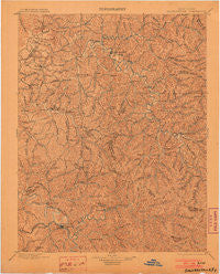
~ Salyersville KY topo map, 1:125000 scale, 30 X 30 Minute, Historical, 1899, updated 1903
Salyersville, Kentucky, USGS topographic map dated 1899.
Includes geographic coordinates (latitude and longitude). This topographic map is suitable for hiking, camping, and exploring, or framing it as a wall map.
Printed on-demand using high resolution imagery, on heavy weight and acid free paper, or alternatively on a variety of synthetic materials.
Topos available on paper, Waterproof, Poly, or Tyvek. Usually shipping rolled, unless combined with other folded maps in one order.
- Product Number: USGS-5294978
- Free digital map download (high-resolution, GeoPDF): Salyersville, Kentucky (file size: 7 MB)
- Map Size: please refer to the dimensions of the GeoPDF map above
- Weight (paper map): ca. 55 grams
- Map Type: POD USGS Topographic Map
- Map Series: HTMC
- Map Verison: Historical
- Cell ID: 66579
- Scan ID: 804304
- Imprint Year: 1903
- Survey Year: 1897
- Datum: Unstated
- Map Projection: Unstated
- Map published by United States Geological Survey
- Map Language: English
- Scanner Resolution: 508 dpi
- Map Cell Name: Saylersville
- Grid size: 30 X 30 Minute
- Date on map: 1899
- Map Scale: 1:125000
- Geographical region: Kentucky, United States
Neighboring Maps:
All neighboring USGS topo maps are available for sale online at a variety of scales.
Spatial coverage:
Topo map Salyersville, Kentucky, covers the geographical area associated the following places:
- Helechawa - Belknap - Gullett - Hazel Green - Falcon - Straight Creek (historical) - Seitz - Landsaw - Holliday - Mashfork - Big Woods - Kernie - Foraker - Baileyfield (historical) - Lykins - Dan - Guerrant - Wolf Pen (historical) - Upper Sandlick (historical) - Swampton - Skaggs (historical) - Bethany - Ophir - Baptist - Nickell - Twentysix - Guage - Rousseau - Rose Chapel (historical) - Upper White Oak Creek (historical) - Logville - Stevenson - College Heights (historical) - Elkatawa - Middle Fork (historical) - Taulbee - Paxton - Leatha - Chenowee - Tiptop - Caskey Settement (historical) - Mima - Cyrus - Wolverine - Panama - Rush Branch (historical) - Moct - Neal Valley (historical) - Artville - Wilstacy - Matthew - Index - Netty - Pine Grove (historical) - Stillwater - Sewell - Coffee Creek (historical) - Lee City - Minefork - Rock Lick - Elamton - Ezel - Back (historical) - Wilhurst - Gillmore - Head of Stacy Fork (historical) - Right Fork (historical) - Daysboro - Gifford - Craft (historical) - Rockhouse (historical) - Panhandle - Yocum - Dingus - Wonnie - Adele - Elsie - Kragon - Jericho (historical) - Malaga - Hendricks - Bear Wallow (historical) - Craft Fork (historical) - Woodsbend - Vancleve - Licking River - Cutuno - Tarkiln (historical) - Fannin (historical) - Liberty Road - Cisco - Malone - Lawson - Vance Fork (historical) - Sellars - Bays - Burning Fork - Odfield Mobile Home Park - Flat Fork - Lower Burning Fork (historical)
- Map Area ID: AREA3837.5-83.5-83
- Northwest corner Lat/Long code: USGSNW38-83.5
- Northeast corner Lat/Long code: USGSNE38-83
- Southwest corner Lat/Long code: USGSSW37.5-83.5
- Southeast corner Lat/Long code: USGSSE37.5-83
- Northern map edge Latitude: 38
- Southern map edge Latitude: 37.5
- Western map edge Longitude: -83.5
- Eastern map edge Longitude: -83


