
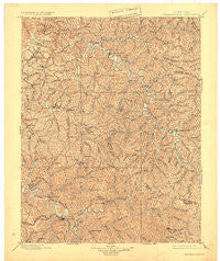
~ Salyersville KY topo map, 1:125000 scale, 30 X 30 Minute, Historical, 1899, updated 1924
Salyersville, Kentucky, USGS topographic map dated 1899.
Includes geographic coordinates (latitude and longitude). This topographic map is suitable for hiking, camping, and exploring, or framing it as a wall map.
Printed on-demand using high resolution imagery, on heavy weight and acid free paper, or alternatively on a variety of synthetic materials.
Topos available on paper, Waterproof, Poly, or Tyvek. Usually shipping rolled, unless combined with other folded maps in one order.
- Product Number: USGS-5294974
- Free digital map download (high-resolution, GeoPDF): Salyersville, Kentucky (file size: 8 MB)
- Map Size: please refer to the dimensions of the GeoPDF map above
- Weight (paper map): ca. 55 grams
- Map Type: POD USGS Topographic Map
- Map Series: HTMC
- Map Verison: Historical
- Cell ID: 66579
- Scan ID: 709684
- Imprint Year: 1924
- Survey Year: 1897
- Datum: NAD
- Map Projection: Polyconic
- Map published by United States Geological Survey
- Map Language: English
- Scanner Resolution: 508 dpi
- Map Cell Name: Saylersville
- Grid size: 30 X 30 Minute
- Date on map: 1899
- Map Scale: 1:125000
- Geographical region: Kentucky, United States
Neighboring Maps:
All neighboring USGS topo maps are available for sale online at a variety of scales.
Spatial coverage:
Topo map Salyersville, Kentucky, covers the geographical area associated the following places:
- Artville - Ebon - Wolverine - Daysboro - Cyrus - Tiptop - Cisco - Gifford - Craft Fork (historical) - Jeptha - Ever - Rexville - Lickburg - Upper Gillmore - Perry Bend (historical) - Payton - Rock Lick - Puncheon (historical) - Ophir - Fivemile - Right Middle Fork (historical) - Chenowee - Trent - Bays - Cannel City - Simpson - Caskey Settement (historical) - Lawson - Malaga - Big Woods - Edna - Florress - Toliver - Zag - Kragon - Bethany - Wilstacy - Crockett - Salem - Mize - Wheel Rim - Rosefork - Evanston - Burkhart - Baptist - Straight Creek (historical) - Hazel Green - Dale - Grayfox - Lacey - Lykins - Nickell - Skaggs (historical) - Elsie - Tarkiln (historical) - Licking River - Helechawa - Hollonville - Rockhouse (historical) - Gullett - Middle Fork (historical) - Cutuno - Ova - Duco - Caney - Plutarch - Fritz - Panama - White Oak - Yocum - Bloomington - Noctor - Foraker - Gillmore - Head of Stacy Fork (historical) - Greear - Baileyfield (historical) - Mason - Keck - Minefork - Coffee Creek (historical) - Lunah - Jones Creek (historical) - Logville - Wheelrim Fork (historical) - Sublett - Wells Fork - Twentysix - Holliday - Bethanna - Odfield Mobile Home Park - Bradley - Grassy Creek - Dehart - Pomp - Dingus - Flat Fork - Korea - Upper White Oak Creek (historical) - Stillwater
- Map Area ID: AREA3837.5-83.5-83
- Northwest corner Lat/Long code: USGSNW38-83.5
- Northeast corner Lat/Long code: USGSNE38-83
- Southwest corner Lat/Long code: USGSSW37.5-83.5
- Southeast corner Lat/Long code: USGSSE37.5-83
- Northern map edge Latitude: 38
- Southern map edge Latitude: 37.5
- Western map edge Longitude: -83.5
- Eastern map edge Longitude: -83


