
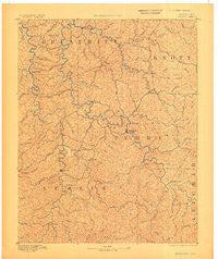
~ Hazard KY topo map, 1:125000 scale, 30 X 30 Minute, Historical, 1891, updated 1906
Hazard, Kentucky, USGS topographic map dated 1891.
Includes geographic coordinates (latitude and longitude). This topographic map is suitable for hiking, camping, and exploring, or framing it as a wall map.
Printed on-demand using high resolution imagery, on heavy weight and acid free paper, or alternatively on a variety of synthetic materials.
Topos available on paper, Waterproof, Poly, or Tyvek. Usually shipping rolled, unless combined with other folded maps in one order.
- Product Number: USGS-5294906
- Free digital map download (high-resolution, GeoPDF): Hazard, Kentucky (file size: 7 MB)
- Map Size: please refer to the dimensions of the GeoPDF map above
- Weight (paper map): ca. 55 grams
- Map Type: POD USGS Topographic Map
- Map Series: HTMC
- Map Verison: Historical
- Cell ID: 65660
- Scan ID: 708843
- Imprint Year: 1906
- Survey Year: 1889
- Datum: Unstated
- Map Projection: Unstated
- Map published by United States Geological Survey
- Map Language: English
- Scanner Resolution: 508 dpi
- Map Cell Name: Hazard
- Grid size: 30 X 30 Minute
- Date on map: 1891
- Map Scale: 1:125000
- Geographical region: Kentucky, United States
Neighboring Maps:
All neighboring USGS topo maps are available for sale online at a variety of scales.
Spatial coverage:
Topo map Hazard, Kentucky, covers the geographical area associated the following places:
- Blue Diamond - Fourseam - Smilax - Mozelle - Fusonia - Big Hill (historical) - Allais - Cornettsville - Fuson (historical) - Hilton - Olivers (historical) - Miller (historical) - Lead Branch (historical) - Chavies - Flintville - Bearville - Grigsby (historical) - Emmalena - Yerkes - Decoy - Canoe - Typo - Combs - Campbell (historical) - Rock Fork (historical) - Hallie - Montgomery (historical) - Hurricane (historical) - Whick - Daisy - Mudlick (historical) - Lothair - Stinnett - Noble - Hardshell - Watts - Dow - Hyden - Ulvah - Baker Camp (historical) - Big Branch (historical) - Walkertown - Butterfly - Glomawr - Banks - Crockettsville - Bowlingtown (historical) - Dunraven - Airport Gardens - Haddix - Napfor - Sassafras - Happy - Thousandsticks - Ary - Red Hill (historical) - Copland - Big Branch (historical) - Clayhole - Woodland Park - Kodak - Sizerock - Leatherwood - Wolf Coal - Asher - Vest - Dice - Gays Creek - Allock - Farler - Vicco - Cutshin - Sebastians Branch - Hoskinston - Tina - Kaliopi - Turkey Creek (historical) - Altro - Saul - Lower McIntosh (historical) - Ritchie - Harveyton - Avawam - Little - Campbell (historical) - Scuddy - Upper Pidgeonroost (historical) - Ned - Eversole (historical) - Lamont - Clear Fork (historical) - Acup (historical) - Stacy - Carr Fork (historical) - Christopher - Dryhill - Wooton - Tilford - Cordia - Slemp
- Map Area ID: AREA37.537-83.5-83
- Northwest corner Lat/Long code: USGSNW37.5-83.5
- Northeast corner Lat/Long code: USGSNE37.5-83
- Southwest corner Lat/Long code: USGSSW37-83.5
- Southeast corner Lat/Long code: USGSSE37-83
- Northern map edge Latitude: 37.5
- Southern map edge Latitude: 37
- Western map edge Longitude: -83.5
- Eastern map edge Longitude: -83


