
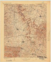
~ Harrodsburg KY topo map, 1:125000 scale, 30 X 30 Minute, Historical, 1905, updated 1931
Harrodsburg, Kentucky, USGS topographic map dated 1905.
Includes geographic coordinates (latitude and longitude). This topographic map is suitable for hiking, camping, and exploring, or framing it as a wall map.
Printed on-demand using high resolution imagery, on heavy weight and acid free paper, or alternatively on a variety of synthetic materials.
Topos available on paper, Waterproof, Poly, or Tyvek. Usually shipping rolled, unless combined with other folded maps in one order.
- Product Number: USGS-5294902
- Free digital map download (high-resolution, GeoPDF): Harrodsburg, Kentucky (file size: 6 MB)
- Map Size: please refer to the dimensions of the GeoPDF map above
- Weight (paper map): ca. 55 grams
- Map Type: POD USGS Topographic Map
- Map Series: HTMC
- Map Verison: Historical
- Cell ID: 65651
- Scan ID: 804191
- Imprint Year: 1931
- Survey Year: 1903
- Datum: Unstated
- Map Projection: Unstated
- Map published by United States Geological Survey
- Map Language: English
- Scanner Resolution: 508 dpi
- Map Cell Name: Harrodsburg
- Grid size: 30 X 30 Minute
- Date on map: 1905
- Map Scale: 1:125000
- Geographical region: Kentucky, United States
Neighboring Maps:
All neighboring USGS topo maps are available for sale online at a variety of scales.
Spatial coverage:
Topo map Harrodsburg, Kentucky, covers the geographical area associated the following places:
- Oakland (historical) - White Oak - Terrapin - Fairview (historical) - Edgewood (historical) - Oak Hill (historical) - Buena Vista - Hall - Fishers Station (historical) - Perryville - Little Needmore - Faulconer - Troy - Junction City - Nealton - Marksbury - Bruners Chapel (historical) - Sulphur Well Park (historical) - Battle (historical) - Sleettown (historical) - Boneyville - Morgan Manor Addition - Rowland - Baralto - McAfee - Gilbert - Danville - Hubble - Three Forks - Houchin (historical) - Pollard - Lexington Park (historical) - Dixon Town - Little Hickman - Brumfield - Wilson Station (historical) - Lynnwood (historical) - Ebenezer - Hanly - Oregon - Stoneybrook - Burgin - Judson - Hyattsville - Crisman Mill (historical) - Teatersville - Fox Creek - Grapevine (historical) - Riverview Estates - Davistown - Bohon - Union Mills - Needmore - Guy (historical) - Cane Hurst (historical) - Perryville Tollgate (historical) - Woodlawn (historical) - Hilldale (historical) - Laurel Hill (historical) - South Elkhorn - Mortonsville - Hickory Grove (historical) - Braxton - Atoka - Vanarsdell - Wilmore Park (historical) - Sweet Home (historical) - West Lynn (historical) - Harris Creek (historical) - Monticello - Ballard - Davis Hill - Maple Lawn (historical) - Jessamine - Forkland - Shakertown - Bryantsville - Milledgeville - Mundys Landing - West Danville - Pinckard - Dunnlora (historical) - Butchertown - Alum Springs - McCreary - Moreland - Mount Zenia (historical) - McGary Station (historical) - Salvisa - Parksville - Nonesuch - Hickory Grove - Maplewood (historical) - Lancaster - Cummins Ferry (historical) - Nevada - Stone - Sidney (historical) - Blueberry Hill - Logantown
- Map Area ID: AREA3837.5-85-84.5
- Northwest corner Lat/Long code: USGSNW38-85
- Northeast corner Lat/Long code: USGSNE38-84.5
- Southwest corner Lat/Long code: USGSSW37.5-85
- Southeast corner Lat/Long code: USGSSE37.5-84.5
- Northern map edge Latitude: 38
- Southern map edge Latitude: 37.5
- Western map edge Longitude: -85
- Eastern map edge Longitude: -84.5


