
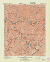
~ Regina KY topo map, 1:62500 scale, 15 X 15 Minute, Historical, 1915, updated 1962
Regina, Kentucky, USGS topographic map dated 1915.
Includes geographic coordinates (latitude and longitude). This topographic map is suitable for hiking, camping, and exploring, or framing it as a wall map.
Printed on-demand using high resolution imagery, on heavy weight and acid free paper, or alternatively on a variety of synthetic materials.
Topos available on paper, Waterproof, Poly, or Tyvek. Usually shipping rolled, unless combined with other folded maps in one order.
- Product Number: USGS-5294682
- Free digital map download (high-resolution, GeoPDF): Regina, Kentucky (file size: 7 MB)
- Map Size: please refer to the dimensions of the GeoPDF map above
- Weight (paper map): ca. 55 grams
- Map Type: POD USGS Topographic Map
- Map Series: HTMC
- Map Verison: Historical
- Cell ID: 61544
- Scan ID: 803926
- Imprint Year: 1962
- Survey Year: 1915
- Datum: NAD27
- Map Projection: Polyconic
- Map published by United States Geological Survey
- Map Language: English
- Scanner Resolution: 508 dpi
- Map Cell Name: Regina
- Grid size: 15 X 15 Minute
- Date on map: 1915
- Map Scale: 1:62500
- Geographical region: Kentucky, United States
Neighboring Maps:
All neighboring USGS topo maps are available for sale online at a variety of scales.
Spatial coverage:
Topo map Regina, Kentucky, covers the geographical area associated the following places:
- Ferrell (historical) - Nelse - Kettlecamp (historical) - Lake Helen Residence (historical) - Dry Fork - East Shelbiana (historical) - Rockhouse - Hurricane Branch (historical) - Mouthcard - Nigh - Kimper - Crooked Creek (historical) - Fishtrap (historical) - Levisa Junction - Greasy Creek - Upper Chloe (historical) - Lookout - Draffin - Upper Pompey (historical) - Honey Fork - Shelbiana - Simers - Ratliff - Red Creek (historical) - Edgewater - Hellier - Republic - Garden Village - Woodside - Jonkan (historical) - Justiceville - Branham Heights (historical) - Millard - Biggs - Axtell (historical) - Venters - Beaver Bottom - Ashcamp - Allegheny (historical) - Head of Johnson Creek (historical) - Sutton - Mikegrady - Wolfpit - Elkhorn City - Lower Pompey (historical) - Henry Clay - Lower Greasy Creek (historical) - Federal - Phyllis - Lick Creek - Beaver Creek (historical) - Marrowbone - Dunleary - Senterville (historical) - Breaks - Cedarville - Big Branch - Liberty (historical) - Daniels Creek (historical) - Raccoon - Road Junction - Belcher
- Map Area ID: AREA37.537.25-82.5-82.25
- Northwest corner Lat/Long code: USGSNW37.5-82.5
- Northeast corner Lat/Long code: USGSNE37.5-82.25
- Southwest corner Lat/Long code: USGSSW37.25-82.5
- Southeast corner Lat/Long code: USGSSE37.25-82.25
- Northern map edge Latitude: 37.5
- Southern map edge Latitude: 37.25
- Western map edge Longitude: -82.5
- Eastern map edge Longitude: -82.25


