
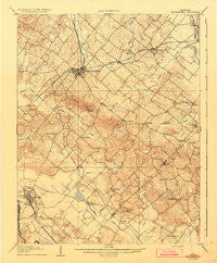
~ Morganfield KY topo map, 1:62500 scale, 15 X 15 Minute, Historical, 1907, updated 1935
Morganfield, Kentucky, USGS topographic map dated 1907.
Includes geographic coordinates (latitude and longitude). This topographic map is suitable for hiking, camping, and exploring, or framing it as a wall map.
Printed on-demand using high resolution imagery, on heavy weight and acid free paper, or alternatively on a variety of synthetic materials.
Topos available on paper, Waterproof, Poly, or Tyvek. Usually shipping rolled, unless combined with other folded maps in one order.
- Product Number: USGS-5294586
- Free digital map download (high-resolution, GeoPDF): Morganfield, Kentucky (file size: 5 MB)
- Map Size: please refer to the dimensions of the GeoPDF map above
- Weight (paper map): ca. 55 grams
- Map Type: POD USGS Topographic Map
- Map Series: HTMC
- Map Verison: Historical
- Cell ID: 57883
- Scan ID: 803803
- Imprint Year: 1935
- Survey Year: 1906
- Datum: Unstated
- Map Projection: Polyconic
- Map published by United States Geological Survey
- Map Language: English
- Scanner Resolution: 508 dpi
- Map Cell Name: Morganfield
- Grid size: 15 X 15 Minute
- Date on map: 1907
- Map Scale: 1:62500
- Geographical region: Kentucky, United States
Neighboring Maps:
All neighboring USGS topo maps are available for sale online at a variety of scales.
Spatial coverage:
Topo map Morganfield, Kentucky, covers the geographical area associated the following places:
- Pride - Eberly (historical) - McClure (historical) - Givens - Waverly - Williams - Shelton - Flournoy - Yuba - Topeka Crossroads (historical) - Harding - Hazel - Sturgis - Arnold - Chapman - Morganfield - Boxville - Shrote - Breckinridge Center - Hamner - King Mills - Bordley - Kern Orchard - Saint Vincent - Cullen - Free Union - Hearin
- Map Area ID: AREA37.7537.5-88-87.75
- Northwest corner Lat/Long code: USGSNW37.75-88
- Northeast corner Lat/Long code: USGSNE37.75-87.75
- Southwest corner Lat/Long code: USGSSW37.5-88
- Southeast corner Lat/Long code: USGSSE37.5-87.75
- Northern map edge Latitude: 37.75
- Southern map edge Latitude: 37.5
- Western map edge Longitude: -88
- Eastern map edge Longitude: -87.75


