
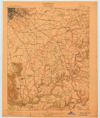
~ Louisville KY topo map, 1:62500 scale, 15 X 15 Minute, Historical, 1907
Louisville, Kentucky, USGS topographic map dated 1907.
Includes geographic coordinates (latitude and longitude). This topographic map is suitable for hiking, camping, and exploring, or framing it as a wall map.
Printed on-demand using high resolution imagery, on heavy weight and acid free paper, or alternatively on a variety of synthetic materials.
Topos available on paper, Waterproof, Poly, or Tyvek. Usually shipping rolled, unless combined with other folded maps in one order.
- Product Number: USGS-5294522
- Free digital map download (high-resolution, GeoPDF): Louisville, Kentucky (file size: 5 MB)
- Map Size: please refer to the dimensions of the GeoPDF map above
- Weight (paper map): ca. 55 grams
- Map Type: POD USGS Topographic Map
- Map Series: HTMC
- Map Verison: Historical
- Cell ID: 56934
- Scan ID: 804239
- Woodland Tint: Yes
- Survey Year: 1905
- Datum: Unstated
- Map Projection: Unstated
- Map published by United States Geological Survey
- Map Language: English
- Scanner Resolution: 508 dpi
- Map Cell Name: Louisville
- Grid size: 15 X 15 Minute
- Date on map: 1907
- Map Scale: 1:62500
- Geographical region: Kentucky, United States
Neighboring Maps:
All neighboring USGS topo maps are available for sale online at a variety of scales.
Spatial coverage:
Topo map Louisville, Kentucky, covers the geographical area associated the following places:
- Sycamore - Glenmary - Fairmount - Prestonia - Bryan (historical) - Zoneton - West Buechel - Poplar Hills - Fairmeade - South Park - Spring Mill - Thixton - Forest Hills - Heritage Creek - Lynnview - Highlands - Okolona - Springlee - Hurstbourne - German Town - Hurstbourne Acres - Tucker Station - Houston Acres - Smithville - Lincolnshire - Brooks - Parkway Village - Kingsley - Audubon Park - Smyrna - Douglas Hills East - Whitner - Hollyvilla - Jeffersontown - Strathmoor Gardens - Mansfield Estates - Knopp - Fox Chase - Hacienda - South Park View - Hunters Hollow - Brentlinger - Saint Regis Park - Douglass Hills - Pioneer Village - Hillview - Seatonville - Highview - Seneca Gardens - Gap in Knob - Camp Taylor - Strathmoor Manor - Bon Air Estates - Lovvorn (historical) - Cooper (historical) - Watterson Park - Buechel - Hollow Creek - Cambridge - Petersburg - Highgate Springs - Cherokee Garden - Hebron Estates - Strathmoor Village - Watterson Woods - Wildwood - Dravo - Fern Creek - Hebron (historical) - Broad Fields - Plymouth Village - Mount Washington - Hopewell - Meadowview Estates - Woodland Hills - Louisville/Jefferson County metro government (balance) - Newburg - Blue Ridge Manor - Middletown - Wellington - Parkside - Ashville - Norbourne Estates
- Map Area ID: AREA38.2538-85.75-85.5
- Northwest corner Lat/Long code: USGSNW38.25-85.75
- Northeast corner Lat/Long code: USGSNE38.25-85.5
- Southwest corner Lat/Long code: USGSSW38-85.75
- Southeast corner Lat/Long code: USGSSE38-85.5
- Northern map edge Latitude: 38.25
- Southern map edge Latitude: 38
- Western map edge Longitude: -85.75
- Eastern map edge Longitude: -85.5


