
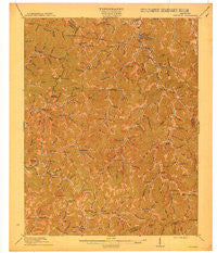
~ Hindman KY topo map, 1:62500 scale, 15 X 15 Minute, Historical, 1915
Hindman, Kentucky, USGS topographic map dated 1915.
Includes geographic coordinates (latitude and longitude). This topographic map is suitable for hiking, camping, and exploring, or framing it as a wall map.
Printed on-demand using high resolution imagery, on heavy weight and acid free paper, or alternatively on a variety of synthetic materials.
Topos available on paper, Waterproof, Poly, or Tyvek. Usually shipping rolled, unless combined with other folded maps in one order.
- Product Number: USGS-5294454
- Free digital map download (high-resolution, GeoPDF): Hindman, Kentucky (file size: 7 MB)
- Map Size: please refer to the dimensions of the GeoPDF map above
- Weight (paper map): ca. 55 grams
- Map Type: POD USGS Topographic Map
- Map Series: HTMC
- Map Verison: Historical
- Cell ID: 55358
- Scan ID: 708903
- Woodland Tint: Yes
- Survey Year: 1912
- Datum: Unstated
- Map Projection: Unstated
- Map published by United States Geological Survey
- Map Language: English
- Scanner Resolution: 508 dpi
- Map Cell Name: Hindman
- Grid size: 15 X 15 Minute
- Date on map: 1915
- Map Scale: 1:62500
- Geographical region: Kentucky, United States
Neighboring Maps:
All neighboring USGS topo maps are available for sale online at a variety of scales.
Spatial coverage:
Topo map Hindman, Kentucky, covers the geographical area associated the following places:
- Glo - Hueysville (historical) - Kite - Raven - Porter (historical) - Omaha - Hollybush - Betty - Puncheon - Mousie - Amburgey - Sylvester (historical) - Welco Station - Hall - Porter Junction - West Garrett - Pippa Passes - Estill - Martinsville (historical) - Soft Shell - Bosco - May - Minnie - Dema - Garrett - Pine Top - Spider - Wayland - Rock Fork (historical) - Lackey - Dry Creek - Nealy - Handshoe - Brinkley - Drew - Bolyn - Odgen Gap - Garner - Larkslane - Hindman - Leburn
- Map Area ID: AREA37.537.25-83-82.75
- Northwest corner Lat/Long code: USGSNW37.5-83
- Northeast corner Lat/Long code: USGSNE37.5-82.75
- Southwest corner Lat/Long code: USGSSW37.25-83
- Southeast corner Lat/Long code: USGSSE37.25-82.75
- Northern map edge Latitude: 37.5
- Southern map edge Latitude: 37.25
- Western map edge Longitude: -83
- Eastern map edge Longitude: -82.75


