
~ Patoka IN topo map, 1:125000 scale, 30 X 30 Minute, Historical, 1903
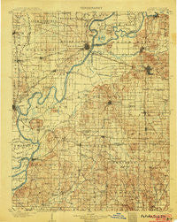
Patoka, Indiana, USGS topographic map dated 1903.
Includes geographic coordinates (latitude and longitude). This topographic map is suitable for hiking, camping, and exploring, or framing it as a wall map.
Printed on-demand using high resolution imagery, on heavy weight and acid free paper, or alternatively on a variety of synthetic materials.
Topos available on paper, Waterproof, Poly, or Tyvek. Usually shipping rolled, unless combined with other folded maps in one order.
- Product Number: USGS-5289218
- Free digital map download (high-resolution, GeoPDF): Patoka, Indiana (file size: 10 MB)
- Map Size: please refer to the dimensions of the GeoPDF map above
- Weight (paper map): ca. 55 grams
- Map Type: POD USGS Topographic Map
- Map Series: HTMC
- Map Verison: Historical
- Cell ID: 320720
- Scan ID: 160522
- Survey Year: 1902
- Datum: Unstated
- Map Projection: Unstated
- Map published by United States Geological Survey
- Map Language: English
- Scanner Resolution: 600 dpi
- Map Cell Name: Patoka
- Grid size: 30 X 30 Minute
- Date on map: 1903
- Map Scale: 1:125000
- Geographical region: Indiana, United States
Neighboring Maps:
All neighboring USGS topo maps are available for sale online at a variety of scales.
Spatial coverage:
Topo map Patoka, Indiana, covers the geographical area associated the following places:
- Melody Hill - Inglefield - Blairsville - Orrville - McGary - Lyles - Lakewood Hills - Barrett - Kratzville - Armstrong - East Mount Carmel - Hillsdale - Odgen - New Hope (historical) - Warrenton - Gards Point - Patoka - Fort Gibson (historical) - Fort Branch - Maud - Hazleton - Mechanicsville - Hepburn - Springfield - McCutchanville - Baldwin Heights - Bellmont - Savah - Mount Carmel - Johnson - Knob Hill - Cynthiana - Saint Joseph - Stringtown - Skelton - Princeton - Cowling - New Harmony - Nisbet - Lippe - Hickory Ridge - King - Griffin - Harwood - Highland - Bone Gap - Mounts - Rochester - Stacer - Schrodts Station - Grayville - Durham - Keensburg - Grafton - Wadesville - Pohaten (historical) - Saint James - Owensville - Saint Wendel - Lexington (historical) - Kasson - Patton - Decker Chapel - Logansburgh (historical) - Douglas - Poseyville - Martin - Cherry Hill Estates - Selma (historical) - Earle - Browns - New Baltimore - White River - Crossroads (historical) - Solitude - Oliver - Little Rock - Crawleyville - Jimtown - Erskine Station - Haubstadt - Darmstadt - Rapture - Egg Harbor - Stewartsville - Country Club Meadows - Parkers Settlement
- Map Area ID: AREA38.538-88-87.5
- Northwest corner Lat/Long code: USGSNW38.5-88
- Northeast corner Lat/Long code: USGSNE38.5-87.5
- Southwest corner Lat/Long code: USGSSW38-88
- Southeast corner Lat/Long code: USGSSE38-87.5
- Northern map edge Latitude: 38.5
- Southern map edge Latitude: 38
- Western map edge Longitude: -88
- Eastern map edge Longitude: -87.5


