
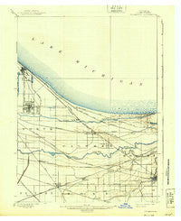
~ Tolleston IN topo map, 1:62500 scale, 15 X 15 Minute, Historical, 1900, updated 1939
Tolleston, Indiana, USGS topographic map dated 1900.
Includes geographic coordinates (latitude and longitude). This topographic map is suitable for hiking, camping, and exploring, or framing it as a wall map.
Printed on-demand using high resolution imagery, on heavy weight and acid free paper, or alternatively on a variety of synthetic materials.
Topos available on paper, Waterproof, Poly, or Tyvek. Usually shipping rolled, unless combined with other folded maps in one order.
- Product Number: USGS-5289098
- Free digital map download (high-resolution, GeoPDF): Tolleston, Indiana (file size: 4 MB)
- Map Size: please refer to the dimensions of the GeoPDF map above
- Weight (paper map): ca. 55 grams
- Map Type: POD USGS Topographic Map
- Map Series: HTMC
- Map Verison: Historical
- Cell ID: 63613
- Scan ID: 161032
- Imprint Year: 1939
- Survey Year: 1897
- Datum: Unstated
- Map Projection: Polyconic
- Map published by United States Geological Survey
- Map Language: English
- Scanner Resolution: 600 dpi
- Map Cell Name: Tolleston
- Grid size: 15 X 15 Minute
- Date on map: 1900
- Map Scale: 1:62500
- Geographical region: Indiana, United States
Neighboring Maps:
All neighboring USGS topo maps are available for sale online at a variety of scales.
Spatial coverage:
Topo map Tolleston, Indiana, covers the geographical area associated the following places:
- Hobart - Anderson Mobile Home Park - Riverside Mobile Home Park - Ivanhoe - Melody Lane Mobile Home Park - Bonfiglio's Mobile Home Park - Hillcrest Manufactured Housing Community - Buffington - Griffith - Black Oak - Sunshine Seven Mobile Home Park - Char-el Mobile Home Park - Honeysuckle Mobile Home Park - Whiting - Duneland Village of Gary - Colfax Mobile Home Park - Clarke Junction - East Chicago - Van Loon - Woodmar - Highland - Hartsdale - Mount Street Mobile Home Park - Village Mobile Home Park - Colonial Mobile Home Park - Glen Park - Gerry Park - Ross Mobile Home Park - Aetna - Osborn - Circle Mobile Home Park - Glenview Mobile Home Park - Indiana Harbor - Duneland Village - Mansard Du Lac - New Chicago - Lottaville - Pine - Noble Mobile Home Park - IXL Mobile Home Park - Gibson - Hessville - Gary - Ross - Ridge Road Mobile Home Community - Liverpool - Avenue Mobile Home Park - Kings Mobile Home Court - Bremerton Mobile Home Park - Miller - Tolleston - Ideal Mobile Home Court
- Map Area ID: AREA41.7541.5-87.5-87.25
- Northwest corner Lat/Long code: USGSNW41.75-87.5
- Northeast corner Lat/Long code: USGSNE41.75-87.25
- Southwest corner Lat/Long code: USGSSW41.5-87.5
- Southeast corner Lat/Long code: USGSSE41.5-87.25
- Northern map edge Latitude: 41.75
- Southern map edge Latitude: 41.5
- Western map edge Longitude: -87.5
- Eastern map edge Longitude: -87.25


