
~ Indianapolis West IN topo map, 1:24000 scale, 7.5 X 7.5 Minute, Historical, 1948
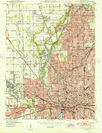
Indianapolis West, Indiana, USGS topographic map dated 1948.
Includes geographic coordinates (latitude and longitude). This topographic map is suitable for hiking, camping, and exploring, or framing it as a wall map.
Printed on-demand using high resolution imagery, on heavy weight and acid free paper, or alternatively on a variety of synthetic materials.
Topos available on paper, Waterproof, Poly, or Tyvek. Usually shipping rolled, unless combined with other folded maps in one order.
- Product Number: USGS-5286202
- Free digital map download (high-resolution, GeoPDF): Indianapolis West, Indiana (file size: 14 MB)
- Map Size: please refer to the dimensions of the GeoPDF map above
- Weight (paper map): ca. 55 grams
- Map Type: POD USGS Topographic Map
- Map Series: HTMC
- Map Verison: Historical
- Cell ID: 21896
- Scan ID: 159822
- Woodland Tint: Yes
- Datum: NAD27
- Map Projection: Polyconic
- Map published by United States Geological Survey
- Map Language: English
- Scanner Resolution: 600 dpi
- Map Cell Name: Indianapolis West
- Grid size: 7.5 X 7.5 Minute
- Date on map: 1948
- Map Scale: 1:24000
- Geographical region: Indiana, United States
Neighboring Maps:
All neighboring USGS topo maps are available for sale online at a variety of scales.
Spatial coverage:
Topo map Indianapolis West, Indiana, covers the geographical area associated the following places:
- North Crows Nest - Glendale - Broad Ripple - Broad Ripple - Woodstock - Belmont - Fairview Station - Indianapolis - City of Indianapolis (balance) - Spring Hills - Clifton - Mapleton - Grandview - Wolfington - Woodruff Place - Lynhurst - North Indianapolis - Wynnedale - Knollton Heights - Brooklyn Heights - Rocky Ripple - Flackville - Highwoods - Shooters Hill - Crows Nest - Mount Jackson - Broadmoor - Wellington
- Map Area ID: AREA39.87539.75-86.25-86.125
- Northwest corner Lat/Long code: USGSNW39.875-86.25
- Northeast corner Lat/Long code: USGSNE39.875-86.125
- Southwest corner Lat/Long code: USGSSW39.75-86.25
- Southeast corner Lat/Long code: USGSSE39.75-86.125
- Northern map edge Latitude: 39.875
- Southern map edge Latitude: 39.75
- Western map edge Longitude: -86.25
- Eastern map edge Longitude: -86.125


