
~ Marion IA topo map, 1:62500 scale, 15 X 15 Minute, Historical, 1888
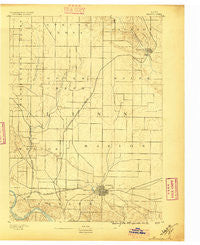
Marion, Iowa, USGS topographic map dated 1888.
Includes geographic coordinates (latitude and longitude). This topographic map is suitable for hiking, camping, and exploring, or framing it as a wall map.
Printed on-demand using high resolution imagery, on heavy weight and acid free paper, or alternatively on a variety of synthetic materials.
Topos available on paper, Waterproof, Poly, or Tyvek. Usually shipping rolled, unless combined with other folded maps in one order.
- Product Number: USGS-5283455
- Free digital map download (high-resolution, GeoPDF): Marion, Iowa (file size: 5 MB)
- Map Size: please refer to the dimensions of the GeoPDF map above
- Weight (paper map): ca. 55 grams
- Map Type: POD USGS Topographic Map
- Map Series: HTMC
- Map Verison: Historical
- Cell ID: 57163
- Scan ID: 175087
- Survey Year: 1888
- Datum: Unstated
- Map Projection: Unstated
- Map published by United States Geological Survey
- Keywords: Nonstandard Press Run
- Map Language: English
- Scanner Resolution: 600 dpi
- Map Cell Name: Marion
- Grid size: 15 X 15 Minute
- Date on map: 1888
- Map Scale: 1:62500
- Geographical region: Iowa, United States
Neighboring Maps:
All neighboring USGS topo maps are available for sale online at a variety of scales.
Spatial coverage:
Topo map Marion, Iowa, covers the geographical area associated the following places:
- Toddville - New Buffalo - Louisa - Central City - Sunset Village - Bali Hai Estates Mobile Home Park - Alice - Alburnett - Midway - Lafayette - Paris - Tower Terrace Mobile Home Park - Rogers - Hiawatha - Robins - Cedar Rapids - Lindale Manor - Five Seasons Manufactured Home Community - Marion Mobile Home Park - Marion - Hiawatha Oak Brook Court - Squaw Creek Village - Eagle Ridge Community - Linn Junction
- Map Area ID: AREA42.2542-91.75-91.5
- Northwest corner Lat/Long code: USGSNW42.25-91.75
- Northeast corner Lat/Long code: USGSNE42.25-91.5
- Southwest corner Lat/Long code: USGSSW42-91.75
- Southeast corner Lat/Long code: USGSSE42-91.5
- Northern map edge Latitude: 42.25
- Southern map edge Latitude: 42
- Western map edge Longitude: -91.75
- Eastern map edge Longitude: -91.5


