
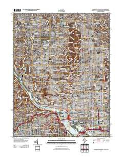
~ Washington West DC topo map, 1:24000 scale, 7.5 X 7.5 Minute, Historical, 2011
Washington West, District of Columbia, USGS topographic map dated 2011.
Includes geographic coordinates (latitude and longitude). This topographic map is suitable for hiking, camping, and exploring, or framing it as a wall map.
Printed on-demand using high resolution imagery, on heavy weight and acid free paper, or alternatively on a variety of synthetic materials.
Topos available on paper, Waterproof, Poly, or Tyvek. Usually shipping rolled, unless combined with other folded maps in one order.
- Product Number: USGS-5278256
- Free digital map download (high-resolution, GeoPDF): Washington West, District of Columbia (file size: 30 MB)
- Map Size: please refer to the dimensions of the GeoPDF map above
- Weight (paper map): ca. 55 grams
- Map Type: POD USGS Topographic Map
- Map Series: US Topo
- Map Verison: Historical
- Cell ID: 47611
- Datum: North American Datum of 1983
- Map Projection: Transverse Mercator
- Map Cell Name: Washington West
- Grid size: 7.5 X 7.5 Minute
- Date on map: 2011
- Map Scale: 1:24000
- Geographical region: District of Columbia, United States
Neighboring Maps:
All neighboring USGS topo maps are available for sale online at a variety of scales.
Spatial coverage:
Topo map Washington West, District of Columbia, covers the geographical area associated the following places:
- Chevy Chase Village - Northwest Park - Chevy Chase - Bradley Woods - Lanier Heights - Adams Morgan - Crestwood - Dupont Circle - Tunlaw Heights (historical) - The Palisades - Takoma Park - Potomac Heights - Thomas Circle - Huntington - Glen Cove - Radnor Heights - Glover Park - Cloisters - Fernwood Heights (historical) - Brightwood Park - Little Indian Rock Terrace - Arlington - Crestview - Green Acres - Bloomingdale - Chevy Chase - Chevy Chase Heights - Youngsborough (historical) - Tohoga (historical) - Park View - Mount Vernon Square - Dover - Greenwich Forest - Carrollsburg (historical) - Lamond Riggs - Shaw - Rock Creek Knolls - Hells Bottom (historical) - Clarendon - Eckington - Ballston - Armsleigh Park (historical) - Rivercrest - Manor Park - Colonial Village - Martins Addition - Pinehurst Circle - Sheridan-Kalorama - Senate Heights - Friendship Heights - Kent - Rosedale Park - Wesley Heights - LeDroit Park - Dobbins Addition (historical) - Crystal Spring Knolls - McLean Gardens - Westboro - Chinatown - Indian Rock Terrace - Glenbrook - Colony Hill - Rock Creek Gardens - East End - Woodley Park - Sumner - Foxhall Crescent - West Chevy Chase Heights - North Gate - Westwood - Sligo - Northwest Rectangle - Metropolis View - Broyhill Forest - Columbia Forest - Whitehall Manor - Bradmoor - Massachusetts Avenue Heights - Robeyville (historical) - Logan Circle - Brinetown (historical) - Georgetown Heights (historical) - Somerset - Carroll Manor - Fort Myer Heights - Glenwood - Varnum - Pretty Prospect (historical) - Westmoreland Terrace - Georgetown - Bloodfield (historical) - Silver Spring Park - Foxhall Village - Truxton Circle - Rock Creek Gardens - Cherrydale - Dunlops Hills - Washington City - Arlingwood - The Hamlet
- Map Area ID: AREA3938.875-77.125-77
- Northwest corner Lat/Long code: USGSNW39-77.125
- Northeast corner Lat/Long code: USGSNE39-77
- Southwest corner Lat/Long code: USGSSW38.875-77.125
- Southeast corner Lat/Long code: USGSSE38.875-77
- Northern map edge Latitude: 39
- Southern map edge Latitude: 38.875
- Western map edge Longitude: -77.125
- Eastern map edge Longitude: -77


