
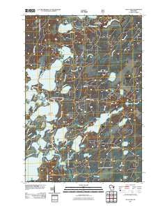
~ Julia Lake WI topo map, 1:24000 scale, 7.5 X 7.5 Minute, Historical, 2011
Julia Lake, Wisconsin, USGS topographic map dated 2011.
Includes geographic coordinates (latitude and longitude). This topographic map is suitable for hiking, camping, and exploring, or framing it as a wall map.
Printed on-demand using high resolution imagery, on heavy weight and acid free paper, or alternatively on a variety of synthetic materials.
Topos available on paper, Waterproof, Poly, or Tyvek. Usually shipping rolled, unless combined with other folded maps in one order.
- Product Number: USGS-5255350
- Free digital map download (high-resolution, GeoPDF): Julia Lake, Wisconsin (file size: 21 MB)
- Map Size: please refer to the dimensions of the GeoPDF map above
- Weight (paper map): ca. 55 grams
- Map Type: POD USGS Topographic Map
- Map Series: US Topo
- Map Verison: Historical
- Cell ID: 22863
- Datum: North American Datum of 1983
- Map Projection: Transverse Mercator
- Map Cell Name: Julia Lake
- Grid size: 7.5 X 7.5 Minute
- Date on map: 2011
- Map Scale: 1:24000
- Geographical region: Wisconsin, United States
Neighboring Maps:
All neighboring USGS topo maps are available for sale online at a variety of scales.
Spatial coverage:
Topo map Julia Lake, Wisconsin, covers the geographical area associated the following places:
- Scott Lake-Shelp Lake State Natural Area - Fourmile Creek - Hay Meadow Creek 2WP944 Dam - Sevenmile Creek - Scott Lake - Shelp Lake - Seven Mile Lake 14 - Scott Creek - Seven Mile 1909c361 Dam - Fourmile Lake - Hay Meadow Flowage - Big Stone Lake - Deer Lake - Spring Lake - Scott-Shelp Lake Hemlock Grove Point of Interest - Hay Meadow Creek - Bailey Lake - Denby Island - Wolf Lake - Whitefish Lake - Three Lakes Municipal Airport - Furbush Lake - Virgin Lake - Little Fork Lake - Three Lakes Seaplane Base - Big Fork Lake - Big Lake - Furbush Creek - The Thoroughfare - Woodbury Lake - Lone Stone Creek - Robbins Lake - Laurel Lake - Hemlock Grove - Hay Meadow Flowage 7 - Julia Creek - Julia Lake - Kimball Creek Snowmobile Parking Lot - Scott Creek Impoundment - Mosquito Creek - Dog Lake - Eagle River - Lone Stone Lake - Laurel Lake Campground - Elm Lake
- Map Area ID: AREA45.87545.75-89.125-89
- Northwest corner Lat/Long code: USGSNW45.875-89.125
- Northeast corner Lat/Long code: USGSNE45.875-89
- Southwest corner Lat/Long code: USGSSW45.75-89.125
- Southeast corner Lat/Long code: USGSSE45.75-89
- Northern map edge Latitude: 45.875
- Southern map edge Latitude: 45.75
- Western map edge Longitude: -89.125
- Eastern map edge Longitude: -89


