
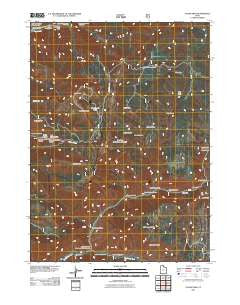
~ Logan Peak UT topo map, 1:24000 scale, 7.5 X 7.5 Minute, Historical, 2011
Logan Peak, Utah, USGS topographic map dated 2011.
Includes geographic coordinates (latitude and longitude). This topographic map is suitable for hiking, camping, and exploring, or framing it as a wall map.
Printed on-demand using high resolution imagery, on heavy weight and acid free paper, or alternatively on a variety of synthetic materials.
Topos available on paper, Waterproof, Poly, or Tyvek. Usually shipping rolled, unless combined with other folded maps in one order.
- Product Number: USGS-5255294
- Free digital map download (high-resolution, GeoPDF): Logan Peak, Utah (file size: 24 MB)
- Map Size: please refer to the dimensions of the GeoPDF map above
- Weight (paper map): ca. 55 grams
- Map Type: POD USGS Topographic Map
- Map Series: US Topo
- Map Verison: Historical
- Cell ID: 26270
- Datum: North American Datum of 1983
- Map Projection: Transverse Mercator
- Map Cell Name: Logan Peak
- Grid size: 7.5 X 7.5 Minute
- Date on map: 2011
- Map Scale: 1:24000
- Geographical region: Utah, United States
Neighboring Maps:
All neighboring USGS topo maps are available for sale online at a variety of scales.
Spatial coverage:
Topo map Logan Peak, Utah, covers the geographical area associated the following places:
- Charles Hollow - Seep Spring - Big Daley - Pig Hole - Gus Lind Flat - Rocky Hollow - Box Spring - Blacksmith Fork Guard Station - Logan Peak - Bear River Range - Banjo Spring - Pig Hole Spring - Spring Picnic Area - Welches Hollow - Friendship Campground - Providence Lake - Leatham Hollow - The Elbow - White Bedground Spring - Upper Spring Hollow Picnic Area - Clark Hollow - First Waterfall Hollow - Box Elder Hollow - Millville Peak - East Cache Division - Ferry Spring - Bridger Campground - Cache County - Adams Corral - Basin Hollow - Richards Hollow - Boar Hole - Hyrum City Park - Sow Hole - White Bedground Camp - Shenoah Campground - Cave Hollow - Big Hollow - White Rock Spring - Cache National Forest - Left Hand Fork Blacksmith Fork Canyon - Pioneer Campground - Lake Bonneville Monument - Hog Hole - Welches Flat - Herd Hollow - Providence Peak - Second Waterfall Hollow - Little Daley - South Hollow - Mahogany Range - Cart Hollow
- Map Area ID: AREA41.7541.625-111.75-111.625
- Northwest corner Lat/Long code: USGSNW41.75-111.75
- Northeast corner Lat/Long code: USGSNE41.75-111.625
- Southwest corner Lat/Long code: USGSSW41.625-111.75
- Southeast corner Lat/Long code: USGSSE41.625-111.625
- Northern map edge Latitude: 41.75
- Southern map edge Latitude: 41.625
- Western map edge Longitude: -111.75
- Eastern map edge Longitude: -111.625


