
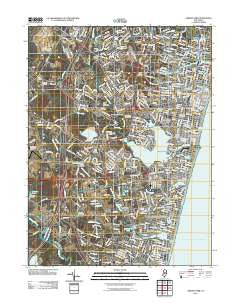
~ Asbury Park NJ topo map, 1:24000 scale, 7.5 X 7.5 Minute, Historical, 2011
Asbury Park, New Jersey, USGS topographic map dated 2011.
Includes geographic coordinates (latitude and longitude). This topographic map is suitable for hiking, camping, and exploring, or framing it as a wall map.
Printed on-demand using high resolution imagery, on heavy weight and acid free paper, or alternatively on a variety of synthetic materials.
Topos available on paper, Waterproof, Poly, or Tyvek. Usually shipping rolled, unless combined with other folded maps in one order.
- Product Number: USGS-5254966
- Free digital map download (high-resolution, GeoPDF): Asbury Park, New Jersey (file size: 27 MB)
- Map Size: please refer to the dimensions of the GeoPDF map above
- Weight (paper map): ca. 55 grams
- Map Type: POD USGS Topographic Map
- Map Series: US Topo
- Map Verison: Historical
- Cell ID: 395767
- Datum: North American Datum of 1983
- Map Projection: Transverse Mercator
- Map Cell Name: Asbury Park
- Grid size: 7.5 X 7.5 Minute
- Date on map: 2011
- Map Scale: 1:24000
- Geographical region: New Jersey, United States
Neighboring Maps:
All neighboring USGS topo maps are available for sale online at a variety of scales.
Spatial coverage:
Topo map Asbury Park, New Jersey, covers the geographical area associated the following places:
- Hamilton - Allenwood - New Bedford - West Belmar - Osbornes Mills - Loch Arbour - Allenhurst - Manasquan - Whitesville - West Deal - Sea Girt - Wanamassa - Spring Lake - Ocean Grove - Deal - West Grove - Bradley Beach - West Allenhurst - Lake Como - Green Grove - Cold Indian Springs - Bradley Park - Algers Mills - South Belmar - Reevytown - Avon-by-the-Sea - Villa Park - Belmar - Interlaken - Spring Lake Heights - Blansingburg - Asbury Park - Glendola - Neptune City - Remsen Mill - Shark River Hills - Baileys Corner
- Map Area ID: AREA40.2540.125-74.125-74
- Northwest corner Lat/Long code: USGSNW40.25-74.125
- Northeast corner Lat/Long code: USGSNE40.25-74
- Southwest corner Lat/Long code: USGSSW40.125-74.125
- Southeast corner Lat/Long code: USGSSE40.125-74
- Northern map edge Latitude: 40.25
- Southern map edge Latitude: 40.125
- Western map edge Longitude: -74.125
- Eastern map edge Longitude: -74


