
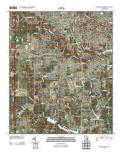
~ Warner Robins SW GA topo map, 1:24000 scale, 7.5 X 7.5 Minute, Historical, 2011
Warner Robins SW, Georgia, USGS topographic map dated 2011.
Includes geographic coordinates (latitude and longitude). This topographic map is suitable for hiking, camping, and exploring, or framing it as a wall map.
Printed on-demand using high resolution imagery, on heavy weight and acid free paper, or alternatively on a variety of synthetic materials.
Topos available on paper, Waterproof, Poly, or Tyvek. Usually shipping rolled, unless combined with other folded maps in one order.
- Product Number: USGS-5247659
- Free digital map download (high-resolution, GeoPDF): Warner Robins SW, Georgia (file size: 19 MB)
- Map Size: please refer to the dimensions of the GeoPDF map above
- Weight (paper map): ca. 55 grams
- Map Type: POD USGS Topographic Map
- Map Series: US Topo
- Map Verison: Historical
- Cell ID: 47501
- Datum: North American Datum of 1983
- Map Projection: Transverse Mercator
- Map Cell Name: Warner Robins SW
- Grid size: 7.5 X 7.5 Minute
- Date on map: 2011
- Map Scale: 1:24000
- Geographical region: Georgia, United States
Neighboring Maps:
All neighboring USGS topo maps are available for sale online at a variety of scales.
Spatial coverage:
Topo map Warner Robins SW, Georgia, covers the geographical area associated the following places:
- Quail Run - Barrington - Woodard Estates - Pilgrim Rest - South Pointe - South Oaks - Pine Forest - Hidden Oaks - South Springs - Russell Glen - Shady Grove - Quail Meadow - Lakeview - Bass - Quail Run North - Dove Cove - Highland Estates - Cardinal Ridge - Idlewood Acres - Peachtree Estates - Beaver Creek - Elmdale Estates - Shirley Hills Estates - Tharpe (historical) - Quail Run North - Houston Lake Woods - Robins Forest West - Heard - Settlers Landing - Devereaux Estates - Wrights Mill - Sleepy Hollow - Woody Acres - The Heather on Houston Lake - Sonja Heights - Doublegate - Turtle Creek
- Map Area ID: AREA32.62532.5-83.75-83.625
- Northwest corner Lat/Long code: USGSNW32.625-83.75
- Northeast corner Lat/Long code: USGSNE32.625-83.625
- Southwest corner Lat/Long code: USGSSW32.5-83.75
- Southeast corner Lat/Long code: USGSSE32.5-83.625
- Northern map edge Latitude: 32.625
- Southern map edge Latitude: 32.5
- Western map edge Longitude: -83.75
- Eastern map edge Longitude: -83.625


