
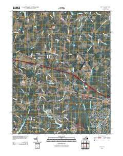
~ Hylas VA topo map, 1:24000 scale, 7.5 X 7.5 Minute, Historical, 2010
Hylas, Virginia, USGS topographic map dated 2010.
Includes geographic coordinates (latitude and longitude). This topographic map is suitable for hiking, camping, and exploring, or framing it as a wall map.
Printed on-demand using high resolution imagery, on heavy weight and acid free paper, or alternatively on a variety of synthetic materials.
Topos available on paper, Waterproof, Poly, or Tyvek. Usually shipping rolled, unless combined with other folded maps in one order.
- Product Number: USGS-5232558
- Free digital map download (high-resolution, GeoPDF): Hylas, Virginia (file size: 21 MB)
- Map Size: please refer to the dimensions of the GeoPDF map above
- Weight (paper map): ca. 55 grams
- Map Type: POD USGS Topographic Map
- Map Series: US Topo
- Map Verison: Historical
- Cell ID: 21640
- Datum: North American Datum of 1983
- Map Projection: Transverse Mercator
- Map Cell Name: Hylas
- Grid size: 7.5 X 7.5 Minute
- Date on map: 2010
- Map Scale: 1:24000
- Geographical region: Virginia, United States
Neighboring Maps:
All neighboring USGS topo maps are available for sale online at a variety of scales.
Spatial coverage:
Topo map Hylas, Virginia, covers the geographical area associated the following places:
- Brittland - Mount Olive Terrace - Broad Run - Pickels - Hermitage Hamlet - Gayton (historical) - Windy Run - Fords - Casco - Bellview Gardens - Johnsons Springs - Homewood Park - Wingmead - Rockville - Samary Forest - Dawnington Sabot - Oak Grove Estates - Centerville - Sycamore Creek - Nelwood Estates - Goosepoint - Hylas - Dover Run - Auburn Chase - Wheatlands - Hickory Haven - Woods Acres
- Map Area ID: AREA37.7537.625-77.75-77.625
- Northwest corner Lat/Long code: USGSNW37.75-77.75
- Northeast corner Lat/Long code: USGSNE37.75-77.625
- Southwest corner Lat/Long code: USGSSW37.625-77.75
- Southeast corner Lat/Long code: USGSSE37.625-77.625
- Northern map edge Latitude: 37.75
- Southern map edge Latitude: 37.625
- Western map edge Longitude: -77.75
- Eastern map edge Longitude: -77.625


