
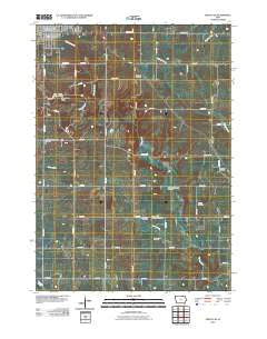
~ Cresco SE IA topo map, 1:24000 scale, 7.5 X 7.5 Minute, Historical, 2010
Cresco SE, Iowa, USGS topographic map dated 2010.
Includes geographic coordinates (latitude and longitude). This topographic map is suitable for hiking, camping, and exploring, or framing it as a wall map.
Printed on-demand using high resolution imagery, on heavy weight and acid free paper, or alternatively on a variety of synthetic materials.
Topos available on paper, Waterproof, Poly, or Tyvek. Usually shipping rolled, unless combined with other folded maps in one order.
- Product Number: USGS-5157459
- Free digital map download (high-resolution, GeoPDF): Cresco SE, Iowa (file size: 10 MB)
- Map Size: please refer to the dimensions of the GeoPDF map above
- Weight (paper map): ca. 55 grams
- Map Type: POD USGS Topographic Map
- Map Series: US Topo
- Map Verison: Historical
- Cell ID: 10691
- Datum: North American Datum of 1983
- Map Projection: Transverse Mercator
- Map Cell Name: Cresco SE
- Grid size: 7.5 X 7.5 Minute
- Date on map: 2010
- Map Scale: 1:24000
- Geographical region: Iowa, United States
Neighboring Maps:
All neighboring USGS topo maps are available for sale online at a variety of scales.
Spatial coverage:
Topo map Cresco SE, Iowa, covers the geographical area associated the following places:
- South Kratz Cemetery - Ryan Farm Cemetery - Sovereign Grain Services Elevator - Turkey River Access State Wildlife Area - Crestwood High School - United Cemetery - Camp Kiwanis - Ladwig Farm Cemetery - Notre Dame Catholic School - Cresco Post Office - Cresco Care Center - Otter Creek - Crestwood High School - Immanuel Lutheran Church - New Oregon Township Cemetery - Turkey River Wildlife Area - Howard County Courthouse - Cardinal Marsh State Wildlife Area - Community Chapel - Howard County Sherriffs Office - Ridgeway Cemetery - Howard County Log Cabin Museum - Cresco City Hall - Howard County Law Library - Turkey River Area - Cresco City Fire Department - Cleghorn Wildlife Area - Steamboat Rock - Cresco (historical) - Saint Johns Lutheran Cemetery - Beadle Park - Gentle Care Chiropractic Clinic - Martinek Wildlife Area - City of Cresco - Orlean Post Office (historical) - Evans Park - Saint Joseph School - Taylor Pond Park - New Oregon Post Office (historical) - German Methodist Cemetery - Township of Lincoln - Saint Joseph Church - Joslyn Chiropractic Clinic - New Oregon - Chimney Rock Canoe Rental and Campground - Cresco Family Dentistry Center - Chihaks Creek
- Map Area ID: AREA43.37543.25-92.125-92
- Northwest corner Lat/Long code: USGSNW43.375-92.125
- Northeast corner Lat/Long code: USGSNE43.375-92
- Southwest corner Lat/Long code: USGSSW43.25-92.125
- Southeast corner Lat/Long code: USGSSE43.25-92
- Northern map edge Latitude: 43.375
- Southern map edge Latitude: 43.25
- Western map edge Longitude: -92.125
- Eastern map edge Longitude: -92


