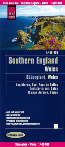
Wales and Southern England
This map appears in the map series entitled World Mapping Project for Reise Know-How. This map includes high quality, clear and modern cartography.
Further details included in this map are:
Contour lines with elevation data
Colored Height layers
Classified road network with distances
Detailed Location Index
The maps of the world mapping project are printed on polyart, a virtually indestructible, absolutely waterproof synthetic paper. It can be any bend and fold without cracking. Furthermore, it is writeable as normal paper, non-toxic and recyclable.
This map is in four languages, including English.
- Product Number: RKH_ENG_WALES_S_19
- Reference Product Number: 2338746M
- ISBN: 9783831773732
- Date of Publication: 6/1/2019
- Folded Size: 10.24 inches high by 4.72 inches wide
- Unfolded (flat) Size: 27.56 inches high by 39.37 inches wide
- Map format: Folded
- Map type: Trade Maps - Road
- Geographical region: United Kingdom
- Geographical subregion: England,Wales


