
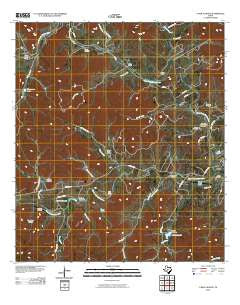
~ A Bar A Ranch TX topo map, 1:24000 scale, 7.5 X 7.5 Minute, Historical, 2010
A Bar A Ranch, Texas, USGS topographic map dated 2010.
Includes geographic coordinates (latitude and longitude). This topographic map is suitable for hiking, camping, and exploring, or framing it as a wall map.
Printed on-demand using high resolution imagery, on heavy weight and acid free paper, or alternatively on a variety of synthetic materials.
Topos available on paper, Waterproof, Poly, or Tyvek. Usually shipping rolled, unless combined with other folded maps in one order.
- Product Number: USGS-5135342
- Free digital map download (high-resolution, GeoPDF): A Bar A Ranch, Texas (file size: 21 MB)
- Map Size: please refer to the dimensions of the GeoPDF map above
- Weight (paper map): ca. 55 grams
- Map Type: POD USGS Topographic Map
- Map Series: US Topo
- Map Verison: Historical
- Cell ID: 19
- Datum: North American Datum of 1983
- Map Projection: Transverse Mercator
- Map Cell Name: A Bar A Ranch
- Grid size: 7.5 X 7.5 Minute
- Date on map: 2010
- Map Scale: 1:24000
- Geographical region: Texas, United States
Neighboring Maps:
All neighboring USGS topo maps are available for sale online at a variety of scales.
Spatial coverage:
Topo map A Bar A Ranch, Texas, covers the geographical area associated the following places:
- Pecan Creek - Cinco B Ranch Airport - A Bar A Ranch - Dewberry Hollow - Gallant Lake - Horse Creek - Circle R Resort Ranch Airport (historical) - Bauerlein Creek - West Prong Cemetery - Bauerlein Cemetery - Carpenter Creek - Wet Hollow - Hough Creek - Thompson Lake Dam - Rocky Creek - Pecan Ranch - Spring Creek - Baker Cemetery - Garrison Lake Dam - Elm Creek - Circle R Sky Ranch - Cazey Creek - Anchor T Ranch - Goodman Cemetery - Stanford Creek - Rhyme Creek - Gallant Lake Dam - Horse Valley Ranch - West Prong Medina River - Benton Creek - Mickle Creek - Chalk Creek - Means Cemetery - Cripple Creek Ranch - Garrison Lake - North Prong Medina River - Wallace Creek - Rocky River Ranch - Thompson Lake - Idlewild Airport - Coalkiln Creek
- Map Area ID: AREA29.87529.75-99.375-99.25
- Northwest corner Lat/Long code: USGSNW29.875-99.375
- Northeast corner Lat/Long code: USGSNE29.875-99.25
- Southwest corner Lat/Long code: USGSSW29.75-99.375
- Southeast corner Lat/Long code: USGSSE29.75-99.25
- Northern map edge Latitude: 29.875
- Southern map edge Latitude: 29.75
- Western map edge Longitude: -99.375
- Eastern map edge Longitude: -99.25


