
Forth Worth, Texas by Rand McNally
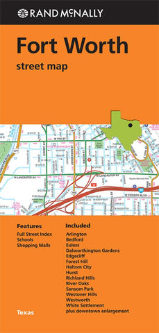
Rand McNallys folded map for Fort Worth is a must-have for anyone traveling in and around this part of Texas, offering unbeatable accuracy and reliability at a great price. Trusted cartography shows all Interstate, U.S., state, and county highways, along with clearly indicated parks, points of interest, airports, county boundaries, and streets. The easy-to-use legend and detailed index make for quick and easy location of destinations.
Regularly updated
Full-color maps
Clearly labeled Interstate, U.S., state, and county highways
Indications of parks, points of interest, airports, county boundaries, schools, shopping malls, downtown & vicinity maps
Easy-to-use legend
Detailed & full street index
Convenient folded size
© 2014
Communities Included: Arlington, Bedford, Euless, Dalworthington Gardens, Edgecliff, Forest Hill, Haltom City, Hurst, Richland Hills, Rover Oaks, Sansom Park, Westover Hills, Westworth, White Settlement plus downtown enlargement.
- Product Number: 2154639M
- Product Code: RM_FT_WORTH
- ISBN: 9780528008894
- Year of Publication: 2014
- Folded Size: 9.06 x 4.33 inches
- Unfolded Size: 26.77 x 38.58 inches
- Map type: Folded Map
- Geographical region: Texas


