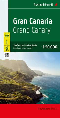
Gran Canaria, road and leisure map 1:50,000
Gran Canaria at 1:50,000 on a GPS-compatible road map from Freytag & Berndt prominently highlighting the island’s main places of interest described in a multilingual booklet attached to the map cover. Many place names are in larger size print than found on most maps of the island.
Gran Canaria’s landscape is presented by contours and relief shading, with plenty of names of peaks, valleys and other topographic features. Road network emphasises main roads, with interchange names prominently marked, and includes local roads and selected country tracks. Driving distances are marked on main routes. Scenic roads are highlighted, as are hiking trails. Icons indicate various facilities and places of interest, including campsites, viewpoints, etc. The island’s best sights are prominently highlighted and described in the accompanying booklet attached to the map cover. The map has a 5km UTM grid plus latitude and longitude margin ticks at 2’ intervals. The index, also in the booklet, li
- Product Number: FB_GR_CAN_RL_23
- Reference Product Number: - None -
- ISBN: 9783707921755
- Date of Publication: 1/1/2023
- Folded Size: 10.02 inches high by 5.11 inches wide
- Unfolded (flat) Size: 10.02 inches high by 5.11 inches wide
- Map format: Folded
- Map type: Trade Maps - Road
- Geographical region: Spain