
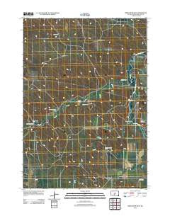
~ White River West SD topo map, 1:24000 scale, 7.5 X 7.5 Minute, Historical, 2012
White River West, South Dakota, USGS topographic map dated 2012.
Includes geographic coordinates (latitude and longitude). This topographic map is suitable for hiking, camping, and exploring, or framing it as a wall map.
Printed on-demand using high resolution imagery, on heavy weight and acid free paper, or alternatively on a variety of synthetic materials.
Topos available on paper, Waterproof, Poly, or Tyvek. Usually shipping rolled, unless combined with other folded maps in one order.
- Product Number: USGS-5649065
- Free digital map download (high-resolution, GeoPDF): White River West, South Dakota (file size: 14 MB)
- Map Size: please refer to the dimensions of the GeoPDF map above
- Weight (paper map): ca. 55 grams
- Map Type: POD USGS Topographic Map
- Map Series: US Topo
- Map Verison: Historical
- Cell ID: 48748
- Datum: North American Datum of 1983
- Map Projection: Transverse Mercator
- Map Cell Name: White River West
- Grid size: 7.5 X 7.5 Minute
- Date on map: 2012
- Map Scale: 1:24000
- Geographical region: South Dakota, United States
Neighboring Maps:
All neighboring USGS topo maps are available for sale online at a variety of scales.
Spatial coverage:
Topo map White River West, South Dakota, covers the geographical area associated the following places:
- Stromer Ranch - Highway 44 Number 6 Dam - Dry Creek - Andy Smith Ranch - Amber Ranch - Gary Astleford Ranch - Iwan Number 1 Dam - Mellette County - Lawrence Krogman Ranch - Gunner Ranch - Carl Gunner Number 1 Dam - Pine Creek - Jensen Ranch - Smith Andy Number 1 Dam - Ken Astleford Ranch - Lawrence Krogman Ranch - Jensen Number 7 Dam - Krogman Number 4 Dam - Winchell Brothers Number 1 Dam - Saint James Cemetery - Jensen Number 5 Dam - White River Cemetery - Lolley Ranch - Ambur Brothers Number 1 Dam - Raffensperger Ranch - Two Hawk Ranch - Highway Department Number 3 Dam - Saint Ignatius Cemetery - Risseeuw Ranch - Highway 44 Dam
- Map Area ID: AREA43.62543.5-100.875-100.75
- Northwest corner Lat/Long code: USGSNW43.625-100.875
- Northeast corner Lat/Long code: USGSNE43.625-100.75
- Southwest corner Lat/Long code: USGSSW43.5-100.875
- Southeast corner Lat/Long code: USGSSE43.5-100.75
- Northern map edge Latitude: 43.625
- Southern map edge Latitude: 43.5
- Western map edge Longitude: -100.875
- Eastern map edge Longitude: -100.75


