
~ Watertown SD topo map, 1:250000 scale, 1 X 2 Degree, Historical, 1958, updated 1958
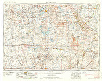
Watertown, South Dakota, USGS topographic map dated 1958.
Includes geographic coordinates (latitude and longitude). This topographic map is suitable for hiking, camping, and exploring, or framing it as a wall map.
Printed on-demand using high resolution imagery, on heavy weight and acid free paper, or alternatively on a variety of synthetic materials.
Topos available on paper, Waterproof, Poly, or Tyvek. Usually shipping rolled, unless combined with other folded maps in one order.
- Product Number: USGS-5609190
- Free digital map download (high-resolution, GeoPDF): Watertown, South Dakota (file size: 18 MB)
- Map Size: please refer to the dimensions of the GeoPDF map above
- Weight (paper map): ca. 55 grams
- Map Type: POD USGS Topographic Map
- Map Series: HTMC
- Map Verison: Historical
- Cell ID: 69089
- Scan ID: 344872
- Imprint Year: 1958
- Woodland Tint: Yes
- Visual Version Number: 1
- Aerial Photo Year: 1952
- Field Check Year: 1953
- Datum: Unstated
- Map Projection: Transverse Mercator
- Map published by United States Geological Survey
- Map Language: English
- Scanner Resolution: 600 dpi
- Map Cell Name: Watertown
- Grid size: 1 X 2 Degree
- Date on map: 1958
- Map Scale: 1:250000
- Geographical region: South Dakota, United States
Neighboring Maps:
All neighboring USGS topo maps are available for sale online at a variety of scales.
Spatial coverage:
Topo map Watertown, South Dakota, covers the geographical area associated the following places:
- Shamrock Colony - De Smet - Cazenovia - Foley - Moritz - Tyler - Vienna - Taunton - Sundahl Trailer Court - Gary - Kampeska - Lake Preston - Artesian - Cloverleaf Colony - Mayfield Colony - Howard - Tunerville - Dawson - Ruthton - Sunnyview - Waverly - Clark Colony - Brandt - Lake Benton - Newdale Colony - Julian (historical) - Claremont Colony - Rutland - Brookings - Bemis - Bushnell - Carthage - Nunda - Wilno - Saint Leo - Altamont - Spring Lake Colony - Madison - Prairie Village - Silver Lake Colony - Roland Colony - Elkton - Clark - Goodwin - Florence - Castlewood - Airlie - Woodstock - Porter - Flandreau - White - Oldham - Roswell - Elrod - Thomas - Raymond - Manchester - Hillcrest Colony - Grover - Sheldon Trailor Town - Vilas - Stone Bridge - Keefton (historical) - Ramona - Norfeld Colony - North Grove Addition - Arco - Cresson - Pearl Creek Colony - Argonne - Bryant - Rauville - Dempster - Iroquois - Astoria - Green Trees Subdivision - Success (historical) - Erwin - Garden City - Yale - Holland - Poinsett Colony - Esmond - Williams Subdivision - Prairie Queen (historical) - Volga - Kones Corner - Badger - Johnsonville - Burr - Ahnberg - North Shore - Lake Norden - Hayti - Fairview (historical) - Arlington Beach - Melham - Appleby - Fordham Colony - Estelline
- Map Area ID: AREA4544-98-96
- Northwest corner Lat/Long code: USGSNW45-98
- Northeast corner Lat/Long code: USGSNE45-96
- Southwest corner Lat/Long code: USGSSW44-98
- Southeast corner Lat/Long code: USGSSE44-96
- Northern map edge Latitude: 45
- Southern map edge Latitude: 44
- Western map edge Longitude: -98
- Eastern map edge Longitude: -96


