
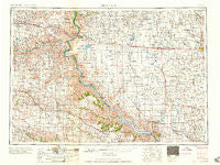
~ Mitchell SD topo map, 1:250000 scale, 1 X 2 Degree, Historical, 1959
Mitchell, South Dakota, USGS topographic map dated 1959.
Includes geographic coordinates (latitude and longitude). This topographic map is suitable for hiking, camping, and exploring, or framing it as a wall map.
Printed on-demand using high resolution imagery, on heavy weight and acid free paper, or alternatively on a variety of synthetic materials.
Topos available on paper, Waterproof, Poly, or Tyvek. Usually shipping rolled, unless combined with other folded maps in one order.
- Product Number: USGS-5609162
- Free digital map download (high-resolution, GeoPDF): Mitchell, South Dakota (file size: 21 MB)
- Map Size: please refer to the dimensions of the GeoPDF map above
- Weight (paper map): ca. 55 grams
- Map Type: POD USGS Topographic Map
- Map Series: HTMC
- Map Verison: Historical
- Cell ID: 68915
- Scan ID: 344857
- Woodland Tint: Yes
- Datum: Unstated
- Map Projection: Transverse Mercator
- Map published by United States Army Corps of Engineers
- Map published by United States Army
- Map Language: English
- Scanner Resolution: 600 dpi
- Map Cell Name: Mitchell
- Grid size: 1 X 2 Degree
- Date on map: 1959
- Map Scale: 1:250000
- Geographical region: South Dakota, United States
Neighboring Maps:
All neighboring USGS topo maps are available for sale online at a variety of scales.
Spatial coverage:
Topo map Mitchell, South Dakota, covers the geographical area associated the following places:
- Bonesteel - Mount Vernon - Hamill - Plankinton - Lake View Colony - Metzgerville - Saint Charles - Gregory - Crow Creek - Kargas Subdivision - Greenwood Colony - Lucas - Mitchell - Wheeler (historical) - Bijou Hills - Pickstown - Grass Ranch Colony - River Bluff Addition - Joubert - Bovee - White Lake - Grandview - Aurora Center - Grandview (historical) - Douglas City (historical) - Wewela - Platte - Iona - Herrick - Dante - Hillside - Shelby - Eagle - Lyman - Storla - Lake Andes - Geddes - Cuthbert - Winner - Dixon - Pukwana - Delmont - Stickney - Kimball - Loomis - Reliance - Letcher - New Holland - Colome - Oacoma - Dezera - Betts - Sand Hill Subdivision - Avon - Burke - Ola - Wagner - Cedar Grove Colony - Grosse - Lyonville - Armour - Platte Colony - Kennebec - Fort Randall - Dallas - Ravinia - Chamberlain - Carlock - Crow Lake - Harrison - Millboro - Fairfax - Academy - Corsica - Ideal - Clearfield Colony
- Map Area ID: AREA4443-100-98
- Northwest corner Lat/Long code: USGSNW44-100
- Northeast corner Lat/Long code: USGSNE44-98
- Southwest corner Lat/Long code: USGSSW43-100
- Southeast corner Lat/Long code: USGSSE43-98
- Northern map edge Latitude: 44
- Southern map edge Latitude: 43
- Western map edge Longitude: -100
- Eastern map edge Longitude: -98


