
~ Aberdeen SD topo map, 1:250000 scale, 1 X 2 Degree, Historical, 1954, updated 1977
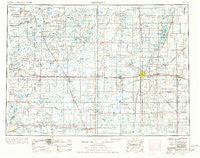
Aberdeen, South Dakota, USGS topographic map dated 1954.
Includes geographic coordinates (latitude and longitude). This topographic map is suitable for hiking, camping, and exploring, or framing it as a wall map.
Printed on-demand using high resolution imagery, on heavy weight and acid free paper, or alternatively on a variety of synthetic materials.
Topos available on paper, Waterproof, Poly, or Tyvek. Usually shipping rolled, unless combined with other folded maps in one order.
- Product Number: USGS-5609116
- Free digital map download (high-resolution, GeoPDF): Aberdeen, South Dakota (file size: 16 MB)
- Map Size: please refer to the dimensions of the GeoPDF map above
- Weight (paper map): ca. 55 grams
- Map Type: POD USGS Topographic Map
- Map Series: HTMC
- Map Verison: Historical
- Cell ID: 68634
- Scan ID: 344833
- Imprint Year: 1977
- Aerial Photo Year: 1975
- Edit Year: 1976
- Datum: Unstated
- Map Projection: Transverse Mercator
- Map published by: Military, Other
- Map Language: English
- Scanner Resolution: 600 dpi
- Map Cell Name: Aberdeen
- Grid size: 1 X 2 Degree
- Date on map: 1954
- Map Scale: 1:250000
- Geographical region: South Dakota, United States
Neighboring Maps:
All neighboring USGS topo maps are available for sale online at a variety of scales.
Spatial coverage:
Topo map Aberdeen, South Dakota, covers the geographical area associated the following places:
- Duxbury - Ferney - Grassland Colony - Lowry - Derian Subdivision - Faulkton - Deerfield Colony - Zeeland - Northville - Huffton - Bath Corner - Aberdeen - Conde - Gallup - Long Lake Colony - Brentwood Colony - Bowdle - Onaka - Craven - Mellette - Prairie Wood Village Addition - Athol - James - Java - Country Village Mobile Park - Winship - Putney - Millard - Hecla - Ipswich - Houghton - Burkmere - Bath - Claremont - Wecota - Groton - Lowell - Spring Creek Colony - Powell - Gederos Estates - Mina - Seneca - Hoven - Richmond Heights - Jobee Acres - Wetonka - Bieglers First Addition - Hosmer - Norbeck - Thunderbird Colony - Hutterville Colony - Melrose Addition - Tacoma Park - Lebanon - Loyalton - Richmond Lake Heights Development - Verdon - Harlin Addition - Leola - Beebe - Mansfield - Tolstoy - Barnard - Plana - Nahon - Plainview Colony - Chelsea - Ordway - Blumengard Colony - Turton - Eureka - Eaton (historical) - Venturia - Cresbard - Randolph - Stratford - Roscoe - Richfield Heights - Columbia - Richmond - Forbes - Artas - Brentford - Deevaan Villa Development - Hillsview - Pleasant Vally Development - Evergreen Colony - Gettysburg - Greenway - Gretna - Rudolph - Craven Corner - Westport - Devoe - Fisher Estates - Long Lake - Frederick - Madra - Warner
- Map Area ID: AREA4645-100-98
- Northwest corner Lat/Long code: USGSNW46-100
- Northeast corner Lat/Long code: USGSNE46-98
- Southwest corner Lat/Long code: USGSSW45-100
- Southeast corner Lat/Long code: USGSSE45-98
- Northern map edge Latitude: 46
- Southern map edge Latitude: 45
- Western map edge Longitude: -100
- Eastern map edge Longitude: -98


