
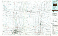
~ Sioux Falls SD topo map, 1:100000 scale, 30 X 60 Minute, Historical, 1985, updated 1985
Sioux Falls, South Dakota, USGS topographic map dated 1985.
Includes geographic coordinates (latitude and longitude). This topographic map is suitable for hiking, camping, and exploring, or framing it as a wall map.
Printed on-demand using high resolution imagery, on heavy weight and acid free paper, or alternatively on a variety of synthetic materials.
Topos available on paper, Waterproof, Poly, or Tyvek. Usually shipping rolled, unless combined with other folded maps in one order.
- Product Number: USGS-5608914
- Free digital map download (high-resolution, GeoPDF): Sioux Falls, South Dakota (file size: 20 MB)
- Map Size: please refer to the dimensions of the GeoPDF map above
- Weight (paper map): ca. 55 grams
- Map Type: POD USGS Topographic Map
- Map Series: HTMC
- Map Verison: Historical
- Cell ID: 68374
- Scan ID: 344717
- Imprint Year: 1985
- Woodland Tint: Yes
- Aerial Photo Year: 1984
- Edit Year: 1985
- Datum: NAD27
- Map Projection: Universal Transverse Mercator
- Planimetric: Yes
- Map published by United States Geological Survey
- Map Language: English
- Scanner Resolution: 600 dpi
- Map Cell Name: Sioux Falls
- Grid size: 30 X 60 Minute
- Date on map: 1985
- Map Scale: 1:100000
- Geographical region: South Dakota, United States
Neighboring Maps:
All neighboring USGS topo maps are available for sale online at a variety of scales.
Spatial coverage:
Topo map Sioux Falls, South Dakota, covers the geographical area associated the following places:
- Country Gables Subdivision - Egan - Ingberg Tracts - Diamond Corner - Luverne - Hartford - Renner Corner - Colton - Brandon - Hills - Rowena - Sorum Heights - Klein Subdivision - Froelich Addition - Ellsworth - Edgerton - West Acres Development - Johnsons Addition - Norton Acres - Trosky - Ash Creek - Hardwick - Jasper Sunrise Village - Corson - Chester - Ellis Corner - Magnolia - Martindale Addition - Kenneth - Silver Valley Addition - Webster Grove Addition - McCroskey Addition - Smiths Park - Erickson Subdivision - Wentworth - Kanaranzi - Hayward Addition - Sherman - Baltic - Swanson's Tracts - Dell Rapids - Leota - Skyline Heights - Renner - El Rancho Acres - Boekhoff Subdivision - Jasper - Manley - Sioux Falls - Meadow View Addition - Huntimer - Lone Tree - Morefield - Cactus Heights - Hatfield - Beaver Creek - Trent - Booge - Split Rock Heights - Iversons Subdivision - Ellis - Lyons - Crooks - East Sioux Falls - Colman - Benclare - Valley Springs - Sorum Addition - Hill Ridge Development - Pine Lakes Addition - Sioux Falls Junction - Andys Acres - Brant Lake - Reppert Addition - Midway - Anderson Subdivision - Oak Park Estates - Country Estates Subdivision - Bruce - Indian Hill Division - Garretson - Ihlen - Steen - South Sioux Falls (historical) - Country Acres
- Map Area ID: AREA4443.5-97-96
- Northwest corner Lat/Long code: USGSNW44-97
- Northeast corner Lat/Long code: USGSNE44-96
- Southwest corner Lat/Long code: USGSSW43.5-97
- Southeast corner Lat/Long code: USGSSE43.5-96
- Northern map edge Latitude: 44
- Southern map edge Latitude: 43.5
- Western map edge Longitude: -97
- Eastern map edge Longitude: -96


