
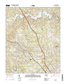
~ Inman SC topo map, 1:24000 scale, 7.5 X 7.5 Minute, Current, 2014
Inman, South Carolina, USGS topographic map dated 2014.
Includes geographic coordinates (latitude and longitude). This topographic map is suitable for hiking, camping, and exploring, or framing it as a wall map.
Printed on-demand using high resolution imagery, on heavy weight and acid free paper, or alternatively on a variety of synthetic materials.
Topos available on paper, Waterproof, Poly, or Tyvek. Usually shipping rolled, unless combined with other folded maps in one order.
- Product Number: USGS-7469556
- Free digital map download (high-resolution, GeoPDF): Inman, South Carolina (file size: 37 MB)
- Map Size: please refer to the dimensions of the GeoPDF map above
- Weight (paper map): ca. 55 grams
- Map Type: POD USGS Topographic Map
- Map Series: US Topo
- Map Verison: Current
- Cell ID: 21951
- Datum: North American Datum of 1983
- Map Projection: Transverse Mercator
- Map Cell Name: Inman
- Grid size: 7.5 X 7.5 Minute
- Date on map: 2014
- Map Scale: 1:24000
- Geographical region: South Carolina, United States
Neighboring Maps:
All neighboring USGS topo maps are available for sale online at a variety of scales.
Spatial coverage:
Topo map Inman, South Carolina, covers the geographical area associated the following places:
- Chestnut Lake - Campton - Dodd Hill - Shiloh - Twin Brooks - Stone Creek - Brown Arrow - Clark Estates - River Oaks - Riverdale - Woodfin - Meadowbrook Farms - Mountain View Mobile Home Park - Hickory Hills - River Forest - Woodridge - River Oak Ranchettes - Highland Park - Inman - Gaines Mobile Home Park - Willow Wood - Tidmans Place - Brannons Store (historical) - North Ridge - Inman Mills - Bondale
- Map Area ID: AREA35.12535-82.125-82
- Northwest corner Lat/Long code: USGSNW35.125-82.125
- Northeast corner Lat/Long code: USGSNE35.125-82
- Southwest corner Lat/Long code: USGSSW35-82.125
- Southeast corner Lat/Long code: USGSSE35-82
- Northern map edge Latitude: 35.125
- Southern map edge Latitude: 35
- Western map edge Longitude: -82.125
- Eastern map edge Longitude: -82


