
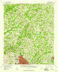
~ Anderson SC topo map, 1:62500 scale, 15 X 15 Minute, Historical, 1957, updated 1958
Anderson, South Carolina, USGS topographic map dated 1957.
Includes geographic coordinates (latitude and longitude). This topographic map is suitable for hiking, camping, and exploring, or framing it as a wall map.
Printed on-demand using high resolution imagery, on heavy weight and acid free paper, or alternatively on a variety of synthetic materials.
Topos available on paper, Waterproof, Poly, or Tyvek. Usually shipping rolled, unless combined with other folded maps in one order.
- Product Number: USGS-5388644
- Free digital map download (high-resolution, GeoPDF): Anderson, South Carolina (file size: 10 MB)
- Map Size: please refer to the dimensions of the GeoPDF map above
- Weight (paper map): ca. 55 grams
- Map Type: POD USGS Topographic Map
- Map Series: HTMC
- Map Verison: Historical
- Cell ID: 50573
- Scan ID: 261780
- Imprint Year: 1958
- Woodland Tint: Yes
- Aerial Photo Year: 1955
- Field Check Year: 1957
- Datum: NAD27
- Map Projection: Polyconic
- Map published by United States Geological Survey
- Map Language: English
- Scanner Resolution: 600 dpi
- Map Cell Name: Anderson
- Grid size: 15 X 15 Minute
- Date on map: 1957
- Map Scale: 1:62500
- Geographical region: South Carolina, United States
Neighboring Maps:
All neighboring USGS topo maps are available for sale online at a variety of scales.
Spatial coverage:
Topo map Anderson, South Carolina, covers the geographical area associated the following places:
- Dobbins Estates - Sherwood Forest - Briarcliff - Colony Hill - Williamsburg Manor - Lakeside - Anderson Village - Spring Park - Pine Acres - North Forks - Autumn Oaks - Welcome - Regency Park - Country Place - Dogwood Heights - Hanover - Bridlewood - Allen Hills - Heritage Trace - Piercetown - Clarendon - Stratford Terrace - Kingswood Terrace - Sweet Gum Trail - Pinecrest - Huntington Hills - Waverly Square - Sunnyside Acres - Green Forest - Lakewood - Five Forks - Carter Hall - Highland Acres - Leeward Landing - Sedgefield - Cedarwood - Gilmer Estates - Meadowbrook Heights - Twin Lakes - Erskine Estates - Knoxwood - Country Acres - Fieldcrest Acres - Chateau Woods - Summer Place - New Salem - West Anderson - Towne Creek Acres - Parkwood - New Prospect Estates - Stonehaven - Windsor Place - Franklin Place - Watson Estates - Centerville - Kings Court - Middleton Shores - Green Hill Plantation - San Mateo - Melbourne Heights - Denver - Loblolly Pines - Centerville Terrace Estates - Mount Vernon - Campbell - Northview - Woodbridge - Cambridge Place - White Plains - Cardinal Park - Country Estates - North Forest Estates - Cedar Acres - Harpers Ridge - Anderson - Park Place - Long Meadows - Oakwood Estates - Lexington Place - McGee Acres - Hammond - Sandy Springs - Marilyn Acres - Hampton Acres - Northlake - Lebanon - Heather Heights - Englewood - Regency Woods - Forest Park - Hunters Trail - Keystone Acres - Dunhill - Brook Hollow - Ashley Downs - Creekwood Hills - Evergreen Hills - Brittany Park - Stonewall Woods - Heritage Hills
- Map Area ID: AREA34.7534.5-82.75-82.5
- Northwest corner Lat/Long code: USGSNW34.75-82.75
- Northeast corner Lat/Long code: USGSNE34.75-82.5
- Southwest corner Lat/Long code: USGSSW34.5-82.75
- Southeast corner Lat/Long code: USGSSE34.5-82.5
- Northern map edge Latitude: 34.75
- Southern map edge Latitude: 34.5
- Western map edge Longitude: -82.75
- Eastern map edge Longitude: -82.5


