
~ Anderson North SC topo map, 1:24000 scale, 7.5 X 7.5 Minute, Historical, 1983, updated 1983
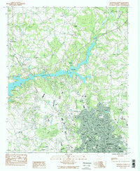
Anderson North, South Carolina, USGS topographic map dated 1983.
Includes geographic coordinates (latitude and longitude). This topographic map is suitable for hiking, camping, and exploring, or framing it as a wall map.
Printed on-demand using high resolution imagery, on heavy weight and acid free paper, or alternatively on a variety of synthetic materials.
Topos available on paper, Waterproof, Poly, or Tyvek. Usually shipping rolled, unless combined with other folded maps in one order.
- Product Number: USGS-5386604
- Free digital map download (high-resolution, GeoPDF): Anderson North, South Carolina (file size: 15 MB)
- Map Size: please refer to the dimensions of the GeoPDF map above
- Weight (paper map): ca. 55 grams
- Map Type: POD USGS Topographic Map
- Map Series: HTMC
- Map Verison: Historical
- Cell ID: 69177
- Scan ID: 260708
- Imprint Year: 1983
- Woodland Tint: Yes
- Visual Version Number: 2
- Aerial Photo Year: 1976
- Edit Year: 1983
- Field Check Year: 1978
- Datum: NAD27
- Map Projection: Lambert Conformal Conic
- Provisional map: Yes
- Map published by United States Geological Survey
- Map Language: English
- Scanner Resolution: 600 dpi
- Map Cell Name: Anderson North
- Grid size: 7.5 X 7.5 Minute
- Date on map: 1983
- Map Scale: 1:24000
- Geographical region: South Carolina, United States
Neighboring Maps:
All neighboring USGS topo maps are available for sale online at a variety of scales.
Spatial coverage:
Topo map Anderson North, South Carolina, covers the geographical area associated the following places:
- Lexington Place - Cedarwood - Harpers Ridge - Forest Park - Evergreen Hills - Woodbridge - New Prospect Estates - Cardinal Park - North Forks - Kings Court - Colony Hill - Stratford Terrace - Hunters Trail - Colonial Hills - Kingsley Hills - Heritage Trace - Middleton Shores - Stonehaven - Bridlewood - Heritage Hills - Leeward Landing - Knoxwood - Anderson Village - Englewood - Denver - Dickerson Acres - Hill and Dale - Carter Hall - Watson Estates - Oakwood Estates - Twin Lakes - Park Place - Brook Hollow - Franklin Place - Northview - Stonewall Woods - Sandy Springs - Sedgefield - Meadowbrook Heights - Loblolly Pines - Welcome - Green Hill Plantation - Lakewood - Towne Creek Acres - Concord - Melbourne Heights - Sunnyside Acres - Anderson - North Forest Estates - Allen Hills - Lebanon - Parkwood - Huntington Hills - Regency Park - Centerville - Gilmer Estates - Waverly Square - Kingswood Terrace - Clearview - Brittany Park - Spring Park - Autumn Oaks - Pine Acres - Lakeside - Hanover - Regency Woods - San Mateo - Quail Hollow - Chateau Woods - New Salem - Summer Place - Holly Creek - Dunhill - Green Forest - Cambridge Place - Centerville Terrace Estates - Ashley Downs - West Anderson - McGee Acres - Dogwood Heights - Williamsburg Manor - Clarendon - Northlake - Sherwood Forest - Mount Vernon - Sweet Gum Trail - Windsor Place - Fieldcrest Acres
- Map Area ID: AREA34.62534.5-82.75-82.625
- Northwest corner Lat/Long code: USGSNW34.625-82.75
- Northeast corner Lat/Long code: USGSNE34.625-82.625
- Southwest corner Lat/Long code: USGSSW34.5-82.75
- Southeast corner Lat/Long code: USGSSE34.5-82.625
- Northern map edge Latitude: 34.625
- Southern map edge Latitude: 34.5
- Western map edge Longitude: -82.75
- Eastern map edge Longitude: -82.625


